| Mesoscale Discussion 924 | |
| < Previous MD | |

|
|
Mesoscale Discussion 0924
NWS Storm Prediction Center Norman OK
0518 PM CDT Sun May 31 2026
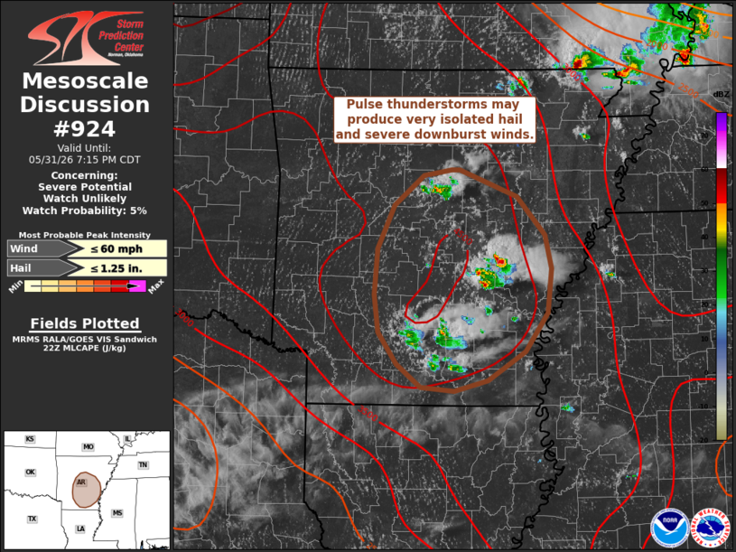
Areas affected...Central to southeast Arkansas
Concerning...Severe potential...Watch unlikely
Valid 312218Z - 010015Z
Probability of Watch Issuance...5 percent
SUMMARY...Pulse convection developing across central into
southeastern Arkansas is showing signs of fully realizing very high
buoyancy across the region. Strong to severe wet downbursts appear
possible, but watch issuance will not be needed.
DISCUSSION...Convection has been percolating across central to
southeastern AR over the past couple of hours, but recent MRMS data
shows echo tops beginning to approach 60 kft - a notable increase
compared to prior convection. Intense updraft pulses are
concurrently noted in GOES 1-minute imagery and suggests that
convection is beginning to fully realize the highly buoyant
environment (MLCAPE upwards of 4000 J/kg) as temperatures reach
their daytime highs in the low 90s. Observed dewpoint depressions
and recent RAP mesoanalysis estimates also suggest low-level lapse
rates are approaching 8 C/km, which when combined with the ample
buoyancy will support wet downbursts capable of producing strong to
severe gusts. Very weak flow through much of the column (as noted in
the KLZK VWP) will promote short-lived pulse convection, though
additional thunderstorm development along any outflow boundaries
appears probable given the very buoyant environment.
..Moore/Guyer.. 05/31/2026
...Please see www.spc.noaa.gov for graphic product...
ATTN...WFO...MEG...JAN...LZK...SHV...
LAT...LON 35469214 35179143 34779108 34429099 33979104 33569133
33269180 33159222 33209263 33449294 33769316 34159322
34639317 35099297 35409259 35459224 35469214
MOST PROBABLE PEAK WIND GUST...UP TO 60 MPH
MOST PROBABLE PEAK HAIL SIZE...UP TO 1.25 IN
|
|
|
Top/All Mesoscale Discussions/Forecast Products/Home |
|
Source link