Northeast Weather Doppler Radar
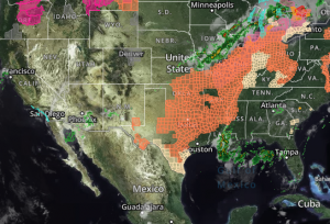
 and Satellite Map

Noutheast United States Weather Doppler radar and satellite will display rain, snow, ice, warnings, statements and advisories on the map. Click map to retrieve additional details from the highlighted locations. Radar map will display the radar and satellite for the following states on page load: Connecticut, Maine, Massachusetts, New Hampshire, New Jersey, New York, Pennsylvania, Rhode Island, Vermont. Scroll to the bottom of this page for further tips on how to use this weather radar and use all of the map features including lightning, wind, marine warnings, storm tracks and more.

NARROW DOWN your weather search here. Enter city or zip below to get your weather!

Search More Weather Locations

Search current weather conditions throughout the United States for the latest forecast, up-to-the-minute watches, warnings and advisories by using our weather search tool below.

Click image to return to the United States Radar main page

united states weather radar

Weather Doppler Radar Map Tips

The information below can be used as a guide for the Cape Weather doppler weather radar map loop.

  • Radar is set to automatically start playing on page load.
  • Radar is automatically set to display weather warnings, statements and advisories.
  • Detailed information can be retrieved directly on the map by clicking the highlighted alert.
  • Future radar mode can be enabled on the bottom left (+7 hours).
  • Geo-locate can be identified on the bottom left for mobile users (Locations).
  • Additional layers and features are located in the “Layers” menu (bottom right).
  • Weather radar is fixed for a location but can be panned /zoomed to different areas on the map.
  • Doppler radar and satellite mode set to update an image every 15 minutes.
  • Switching to radar only mode in the layers menu will update the image every 5 minutes.