| Mesoscale Discussion 793 | |
| < Previous MD | |

|
|
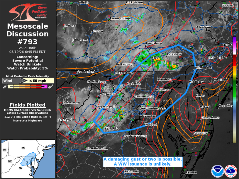
   Mesoscale Discussion 0793
   NWS Storm Prediction Center Norman OK
   0440 PM CDT Tue May 19 2026

   Areas affected...portions of far southeast Pennsylvania into far
   northern Virginia...central Maryland

   Concerning...Severe potential...Watch unlikely

   Valid 192140Z - 192245Z

   Probability of Watch Issuance...5 percent

   SUMMARY...A damaging gust or two may occur with the stronger
   downbursts. The severe threat is very sparse, and a WW issuance is
   not expected.

   DISCUSSION...Widely scattered pulse-cellular storms have matured
   atop a well mixed boundary layer, characterized by low to mid 90s F
   surface temperatures and 8-9 C/km low-level lapse rates. Vertical
   shear, forcing, and mid-level lapse rates are all quite poor. As
   such, the well-mixed boundary layer may promote enough evaporative
   cooling with the stronger wet downbursts to support a damaging gust
   or two. However, the severe threat is very low, with no WW issuance
   anticipated.

   ..Squitieri/Mosier.. 05/19/2026

   ...Please see www.spc.noaa.gov for graphic product...

   ATTN...WFO...PHI...CTP...LWX...

   LAT...LON   38657827 39607742 40067673 40277597 40097557 39747549
               39257579 38837639 38597680 38487721 38427770 38417801
               38657827

   MOST PROBABLE PEAK WIND GUST...UP TO 60 MPH
|
|
|
Top/All Mesoscale Discussions/Forecast Products/Home |
|
Source link