| Mesoscale Discussion 776 | |
| < Previous MD | |

|
|
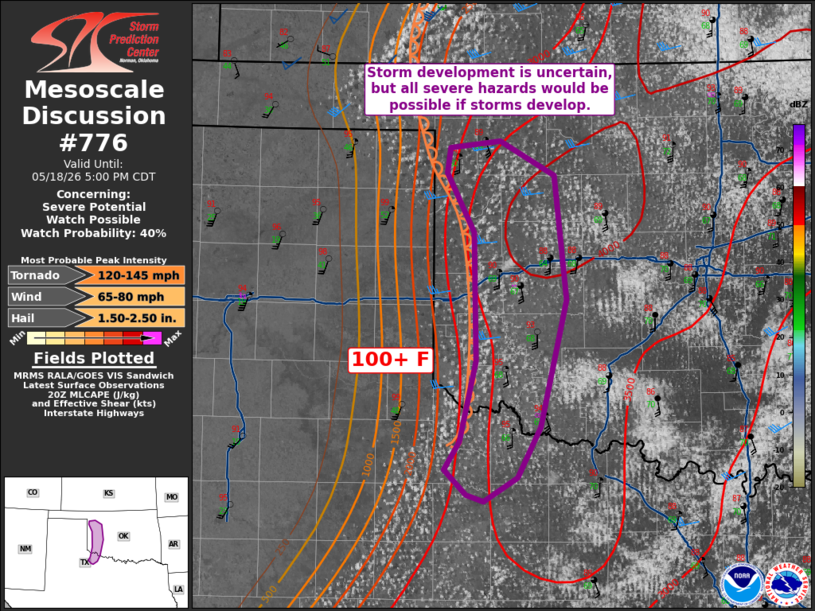
   Mesoscale Discussion 0776
   NWS Storm Prediction Center Norman OK
   0307 PM CDT Mon May 18 2026

   Areas affected...Western Oklahoma into Northwest Texas

   Concerning...Severe potential...Watch possible

   Valid 182007Z - 182200Z

   Probability of Watch Issuance...40 percent

   SUMMARY...Though quite uncertain, storm development along the
   dryline is possible late this afternoon. All severe hazards would be
   possible if storms can form and mature. Convective trends will be
   monitored for a possible watch.

   DISCUSSION...Observations from the West Texas Mesonet show 100+ F
   temperatures within the eastern Panhandle/South Plains. Cumulus
   along the dryline have showed some increase in agitation in
   southwest Oklahoma resulting from the strong dryline circulation.
   While the 18Z OUN sounding did show a capping inversion, a more
   recent TAMDAR sounding from OKC did show very modest cooling/lifting
   of that inversion. Those signs of larger-scale lift may be all that
   will be observed for the remainder of the afternoon/evening. Model
   guidance shows modest mid-level height rises are forecast to occur.
   There is low confidence in storms being able to initiate/mature. If
   a storm or two can form, the environment would support all hazards.
   Convective trends will continue to be monitored.

   ..Wendt/Hart.. 05/18/2026

   ...Please see www.spc.noaa.gov for graphic product...

   ATTN...WFO...OUN...

   LAT...LON   33879923 33699954 33749970 33939990 34159976 34759961
               35729962 36189988 36379984 36419938 36169888 35219877
               34259902 33879923

   MOST PROBABLE PEAK TORNADO INTENSITY...120-145 MPH
   MOST PROBABLE PEAK WIND GUST...65-80 MPH
   MOST PROBABLE PEAK HAIL SIZE...1.50-2.50 IN
|
|
|
Top/All Mesoscale Discussions/Forecast Products/Home |
|
Source link