| Mesoscale Discussion 61 | |
| < Previous MD | |
|
|
Mesoscale Discussion 0061
NWS Storm Prediction Center Norman OK
0202 PM CST Sun Jan 25 2026
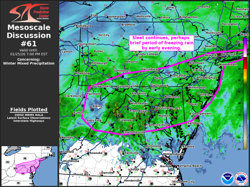
Areas affected...Northern Virginia...Eastern West
Virginia...Southern Pennsylvania...Maryland...Delaware...and New
Jersey into Long Island.
Concerning...Winter mixed precipitation
Valid 252002Z - 260000Z
SUMMARY...Sleet continues this afternoon. A brief period of freezing
rain is possible by early evening.
DISCUSSION...Moderate sleet continues from northern Virginia/eastern
West Virginia to Long Island. As expected, the sleet/snow line has
advanced north with sleet now reported in New York City and Long
Island. From this area and to the southwest, an expansive area of
sleet continues.
While some guidance precipitation algorithms (such as the HRRR)
indicate there may be some freezing rain and ice accretion later
this afternoon, confidence in additional icing is low. Forecast
soundings where the freezing rain is depicted still show boundary
layer temperatures of -10C. Despite it being relatively shallow, it
may remain sufficient for refreezing to sleet. By the time the
profiles look more supportive for freezing rain, precipitation is
coming to an end. Therefore, some pockets of additional icing of 0.1
to 0.2" are possible, but the majority of the precipitation this
afternoon and into the early evening will likely fall as sleet.
In the wake of the primary precipitation shield, forecast soundings
show residual low-level moisture which could result in some freezing
drizzle later this evening.
..Bentley.. 01/25/2026
...Please see www.spc.noaa.gov for graphic product...
ATTN...WFO...OKX...PHI...AKQ...CTP...LWX...RNK...PBZ...RLX...
LAT...LON 39658006 40167843 40397649 40907442 40927382 40947287
40627298 40447382 40067397 39647410 39147450 38497539
38197695 38027847 38157974 38588031 39658006
|
|
|
Top/All Mesoscale Discussions/Forecast Products/Home |
|
Source link