

| Mesoscale Discussion 2454 | |
| < Previous MD | |

|
|
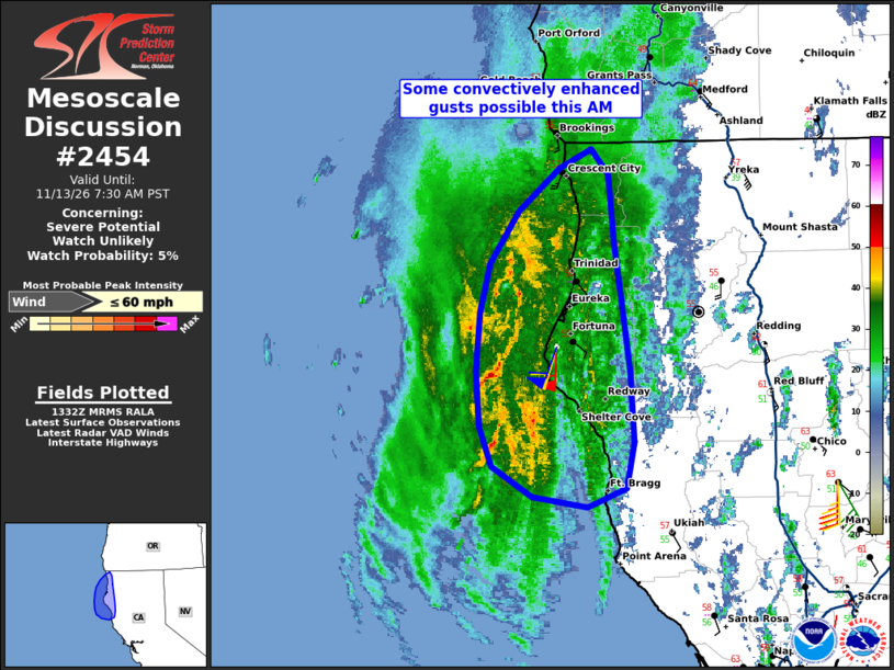
Mesoscale Discussion 2454 NWS Storm Prediction Center Norman OK 0735 AM CST Fri Nov 13 2026 Areas affected...Coastal far northern California Concerning...Severe potential...Watch unlikely Valid 131335Z - 131530Z Probability of Watch Issuance...5 percent SUMMARY...A few convectively enhanced wind gusts could occur this morning along the far northern California coast. DISCUSSION...As a frontal band approaches, several semi-organized/modestly bowing linear segments of convection are noted in the pre-dawn hours in radar imagery off the coast of far northern California amidst broader stratiform precipitation. While this low-topped convection may not be deep enough to produce lightning, it is conceivable that some convective enhancement may influence wind gust potential as these bands progress east-northeastward toward coastal areas this morning. Regarding the robustly strong low-level wind field near the coast, latest WSR-88D VWP data from KBHX is sampling 50-60 kt south-southwesterly winds within the lowest 1-2 km AGL. ..Guyer.. 11/13/2026 ...Please see www.spc.noaa.gov for graphic product... ATTN...WFO...EKA... LAT...LON 39622490 41112492 41942394 41252372 39452361 39622490 MOST PROBABLE PEAK WIND GUST...UP TO 60 MPH |
|
|
Top/All Mesoscale Discussions/Forecast Products/Home |
|
Source link