

| Mesoscale Discussion 2453 | |
| < Previous MD | |

|
|
   Mesoscale Discussion 2453
   NWS Storm Prediction Center Norman OK
   0516 AM CST Fri Nov 13 2026

   Areas affected...Southern California Coast

   Concerning...Severe potential...Watch unlikely

   Valid 131116Z - 131315Z

   Probability of Watch Issuance...5 percent

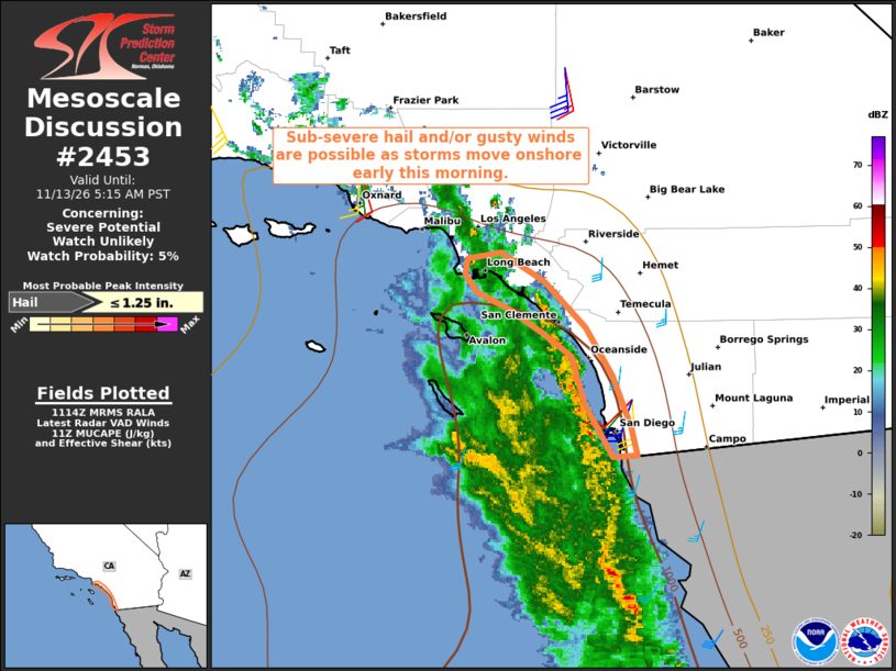
   SUMMARY...Sub-severe hail and/or gusty winds may accompany the
   strongest storms moving onshore through 13Z.

   DISCUSSION...A notable increase in thunderstorms with some transient
   supercell characteristics has been observed over the past hour,
   focused along a sea-breeze boundary from just west of San Clemente
   to west of San Diego. Aided by large-scale forcing for ascent
   preceding a vigorous midlevel trough, the presence of a moist
   boundary-layer coupled with cooling midlevel temperatures is
   yielding a MUCAPE upwards of 1000 J/kg, per latest objective
   analysis. Additionally, area VWPS are sampling relatively weak
   low-level winds, which then strengthen with height, yielding 30-35
   kt of deep-layer shear.

   While severe weather is not expected, the environment appears
   supportive of sub-severe hail and perhaps locally gusty winds as the
   storms move onshore over the next hour or two. Activity should
   weaken fairly quickly as it moves inland into a more stable
   thermodynamic environment.

   ..Mead.. 11/13/2026

   ...Please see www.spc.noaa.gov for graphic product...

   ATTN...WFO...SGX...LOX...

   LAT...LON   32541718 32891740 33191751 33341772 33511799 33621824
               33741834 33841832 33881805 33681772 33391740 33071718
               32741704 32541699 32541718

   MOST PROBABLE PEAK HAIL SIZE...UP TO 1.25 IN
|
|
|
Top/All Mesoscale Discussions/Forecast Products/Home |
|
Source link