

| Mesoscale Discussion 2408 | |
| < Previous MD | |

|
|
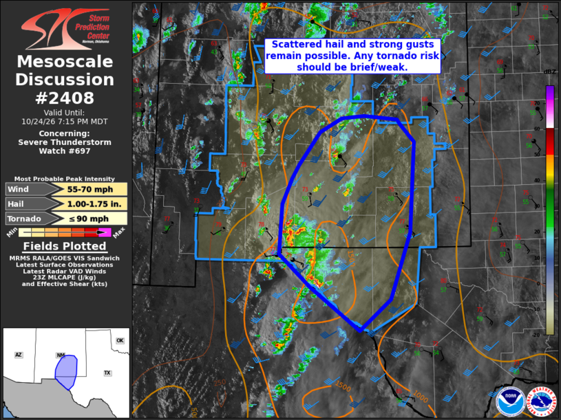
Mesoscale Discussion 2408 NWS Storm Prediction Center Norman OK 0618 PM CDT Sat Oct 24 2026 Areas affected...Far West Texas into southeast New Mexico Concerning...Severe Thunderstorm Watch 697... Valid 242318Z - 250115Z The severe weather threat for Severe Thunderstorm Watch 697 continues. SUMMARY...Hail over 1.00" diameter as well as severe wind gusts of 60-70 mph remain possible into the evening as storms move across Far West Texas and toward southeast New Mexico. DISCUSSION...Beneath moderate southerly winds aloft, storms have developed near a surface trough south of the US border, and have quickly progressed north/northeast across the El Paso area. Cell motions are mainly toward the north/northeast, around 205 deg at 25 kt on average. MLCAPE is over 1000 J/kg with 30-40 kt effective shear, which is supporting the long-lived cells. A few cells have shown more rightward motion, such as the storm north of Fort Hancock TX, and increasing southeasterly boundary-layer winds may aid storm longevity for a few hours into the evening. Low-level shear is generally low, but up to 100 m2/s2 0-1 SRH exists for a right-moving cell. As such, any mesocyclonic enhancement would likely occur with such motions (closer to 220-240 deg). ..Jewell.. 10/24/2026 ...Please see www.spc.noaa.gov for graphic product... ATTN...WFO...MAF...ABQ...EPZ... LAT...LON 31880666 32690660 33100643 33320630 33850589 34070549 34110506 34050442 33970438 33680410 32230419 31170457 30660514 31360607 31880666 MOST PROBABLE PEAK TORNADO INTENSITY...UP TO 90 MPH MOST PROBABLE PEAK WIND GUST...55-70 MPH MOST PROBABLE PEAK HAIL SIZE...1.00-1.75 IN |
|
|
Top/All Mesoscale Discussions/Forecast Products/Home |
|
Source link