

| Mesoscale Discussion 2397 | |
| < Previous MD | |

|
|
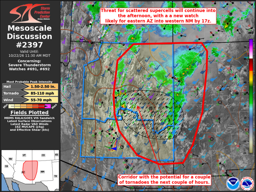
Mesoscale Discussion 2397 NWS Storm Prediction Center Norman OK 1107 AM CDT Thu Oct 22 2026 Areas affected...Eastern Arizona and western New Mexico Concerning...Severe Thunderstorm Watch 691...692... Valid 221607Z - 221730Z The severe weather threat for Severe Thunderstorm Watch 691, 692 continues. SUMMARY...Threat for a mix of supercells and storm clusters will spread eastward from Arizona into New Mexico by this afternoon. A new watch will likely be needed downstream into New Mexico, with the potential for local watch extensions farther west into central AZ. DISCUSSION...Scattered thunderstorms, a few with supercell structures, continue across central and eastern AZ, with the stronger storms focused near the edge of the higher terrain. Convection will likely persist into the afternoon as forcing for ascent develops eastward/northeastward in advance of a midlevel trough over southern CA that will begin to eject east-northeastward. Cloud breaks will contribute to destabilization farther northeast with time across AZ/NM, in an environment with long hodographs favoring splitting supercells and clusters. The stronger low-level shear/hodograph curvature and somewhat richer low-level moisture are focused near the Mogollon Rim in central AZ with some eastward expansion expected into this afternoon, where a couple of tornadoes will be possible. Otherwise, large hail and damaging gusts will be the main concerns through the afternoon. A new watch is likely into western NM by 17z, and some combination of local watch extensions and the new watch will be needed as far west as central AZ. ..Thompson/Guyer.. 10/22/2026 ...Please see www.spc.noaa.gov for graphic product... ATTN...WFO...ABQ...EPZ...GJT...TWC...FGZ...PSR... LAT...LON 32260968 32611072 33551156 34211180 34971187 36311173 36961097 37000868 37000764 36670738 35980741 34270767 32990817 32320861 32260968 MOST PROBABLE PEAK TORNADO INTENSITY...85-110 MPH MOST PROBABLE PEAK WIND GUST...55-70 MPH MOST PROBABLE PEAK HAIL SIZE...1.50-2.50 IN |
|
|
Top/All Mesoscale Discussions/Forecast Products/Home |
|
Source link