

| Mesoscale Discussion 2382 | |
| < Previous MD | |

|
|
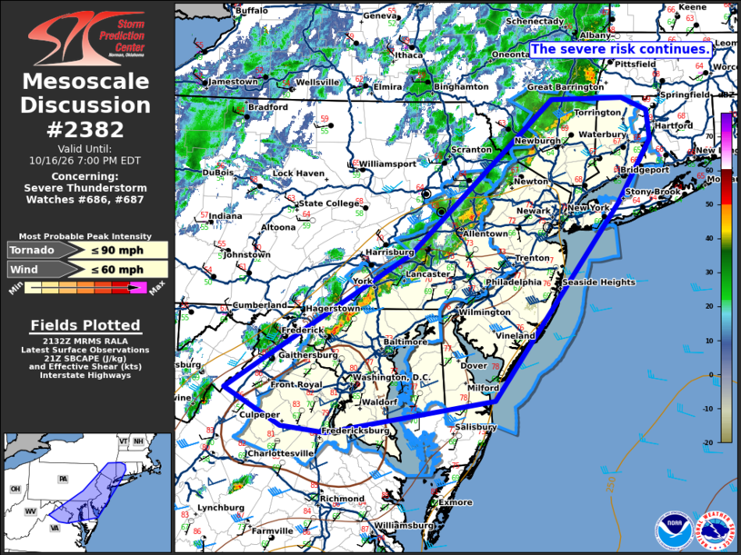
Mesoscale Discussion 2382 NWS Storm Prediction Center Norman OK 0433 PM CDT Fri Oct 16 2026 Areas affected...portions of the Mid Atlantic Concerning...Severe Thunderstorm Watch 686...687... Valid 162133Z - 162300Z The severe weather threat for Severe Thunderstorm Watch 686, 687 continues. SUMMARY...A broken band of low-topped thunderstorms with a history of wind damage should continue eastward this evening. More stable conditions to the east should slowly weaken the complex with time. DISCUSSION...As of 2130 UTC, regional radar imagery over the Northeast/Mid Atlantic showed a broken band of low-topped thunderstorms from southern NY to VA. portions of this line have a history of wind damage across WW686. The environment downstream is strongly sheared, but increasingly stable with SBCAPE decreasing below 500 J/kg across southern New England. Slightly more buoyancy is being observed farther south into the DelMarVa where more clearing has been present. Trends over the last hour show northern portions of the line have weakened and become less organized. This trend is likely to continue as storms move into portions of WW687, though the strength of the background wind field will still favor isolated damaging gusts potential into this evening. The greatest severe potential appears to be focused across southeastern PA, into southern NJ and the Mid Atlantic Coast where warmer and more unstable conditions will persist into the evening hours. Isolated damaging gusts remain possible across WW687 before convection weakens/moves offshore around 2-3z. ..Lyons.. 10/16/2026 ...Please see www.spc.noaa.gov for graphic product... ATTN...WFO...BOX...OKX...ALY...PHI...BGM...AKQ...CTP...LWX... LAT...LON 38837882 40337619 42027416 42027313 41897278 41567273 40877320 38717500 38347738 38427802 38837882 MOST PROBABLE PEAK TORNADO INTENSITY...UP TO 90 MPH MOST PROBABLE PEAK WIND GUST...UP TO 60 MPH |
|
|
Top/All Mesoscale Discussions/Forecast Products/Home |
|
Source link