

| Mesoscale Discussion 2359 | |
| < Previous MD | |

|
|
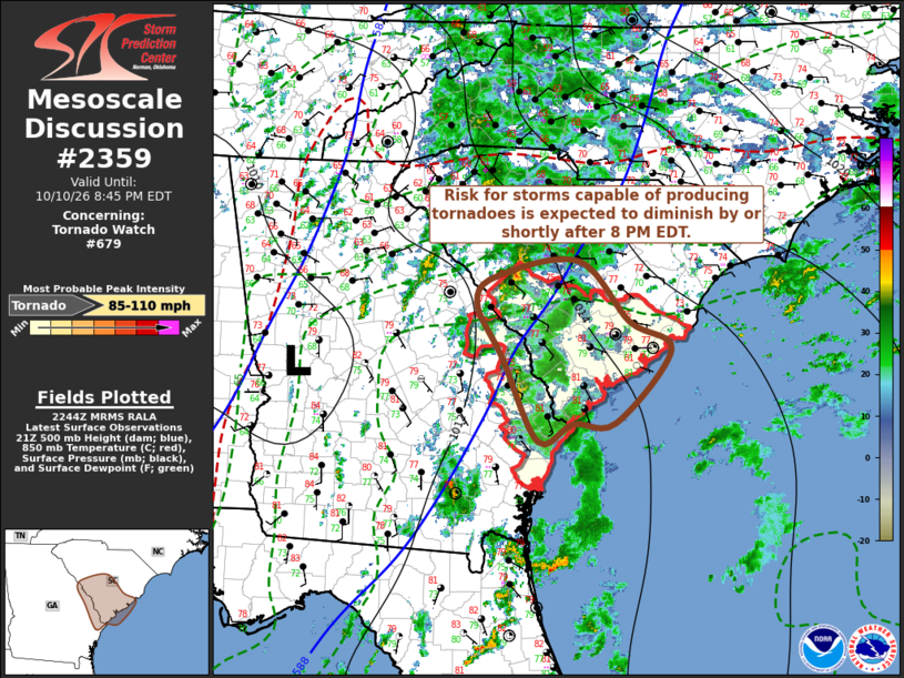
Mesoscale Discussion 2359 NWS Storm Prediction Center Norman OK 0548 PM CDT Sat Oct 10 2026 Areas affected...parts of southern South Carolina and adjacent eastern Georgia Concerning...Tornado Watch 679... Valid 102248Z - 110045Z The severe weather threat for Tornado Watch 679 continues. SUMMARY...Environmental conditions are becoming less conducive to thunderstorms capable of producing tornadoes. Parts of the remaining valid portion of Tornado Watch 679 could be locally extended an hour or so in time this evening, but a new tornado watch is not anticipated. DISCUSSION...Cool surface ridging is maintaining a considerable influence across much of the southern Mid Atlantic, as far south and west as portions of the northeastern South Carolina coastal plain into the Piedmont, where near surface lapse rates remain isothermal or more stable. Strongest low-level shear is focused within the cooler air, and forecast to become increasingly modest within the moist sector through this evening. Coupled with at least subtle boundary-layer cooling within the moist sector over the next couple of hours, the risk for convection capable of producing tornadoes seems likely to diminish by or not long after 11/00Z, even as upstream mid-level troughing slowly pivots east-northeast of the lower Mississippi Valley. ..Kerr.. 10/10/2026 ...Please see www.spc.noaa.gov for graphic product... ATTN...WFO...CHS...CAE... LAT...LON 33718187 33898077 33198008 32887953 32048027 32048084 31848131 32778179 33418214 33718187 MOST PROBABLE PEAK TORNADO INTENSITY...85-110 MPH |
|
|
Top/All Mesoscale Discussions/Forecast Products/Home |
|
Source link