

| Mesoscale Discussion 2349 | |
| < Previous MD | |

|
|
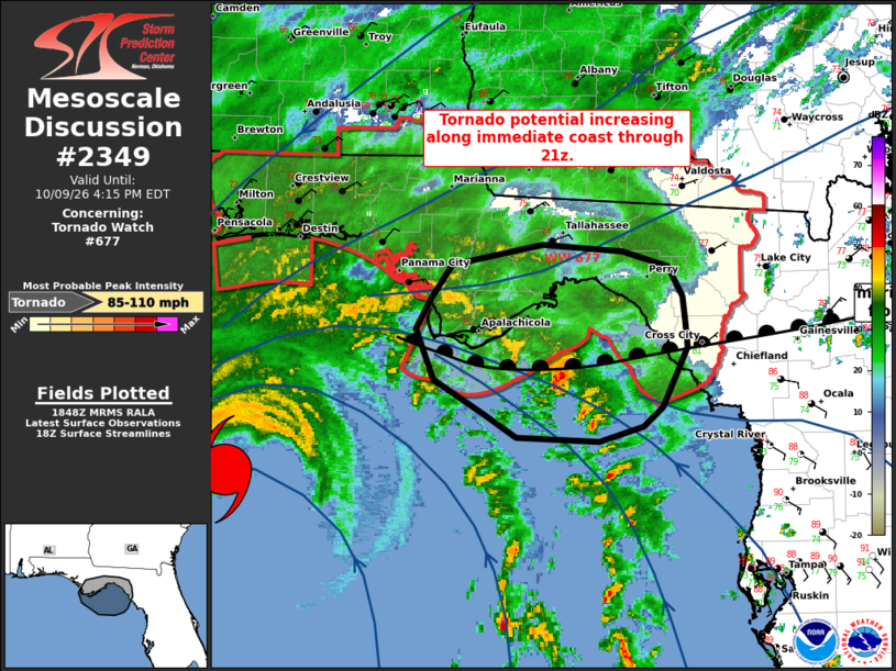
Mesoscale Discussion 2349 NWS Storm Prediction Center Norman OK 0151 PM CDT Fri Oct 09 2026 Areas affected...FL Panhandle coast Concerning...Tornado Watch 677... Valid 091851Z - 092015Z The severe weather threat for Tornado Watch 677 continues. SUMMARY...Tornado potential will increase through 21z/5pm ET along the immediate coast of the central/eastern FL Panhandle. DISCUSSION...A stronger supercell has been noted offshore from Franklin County FL over the past 30 minutes. This cell is very near the surface marine front and has shown signs of stronger low-level rotation as it ingested strong low-level instability and enhanced 0-1 km SRH near the surface front. This boundary should continue to lift northward over the next couple hours, allowing for richer low-level moisture and increased low-level instability impinging on the immediate coast. The tornado risk will increase as this occurs as supercells within the outer rainbands of Isaias move onshore. ..Leitman.. 10/09/2026 ...Please see www.spc.noaa.gov for graphic product... ATTN...WFO...TAE... LAT...LON 29018360 28908398 28948466 29108494 29358535 29728550 29958537 30208521 30358444 30298377 30188339 29968328 29808325 29608323 29158344 29018360 MOST PROBABLE PEAK TORNADO INTENSITY...85-110 MPH |
|
|
Top/All Mesoscale Discussions/Forecast Products/Home |
|
Source link