

| Mesoscale Discussion 2340 | |
| < Previous MD | |

|
|
   Mesoscale Discussion 2340
   NWS Storm Prediction Center Norman OK
   0500 PM CDT Wed Sep 30 2026

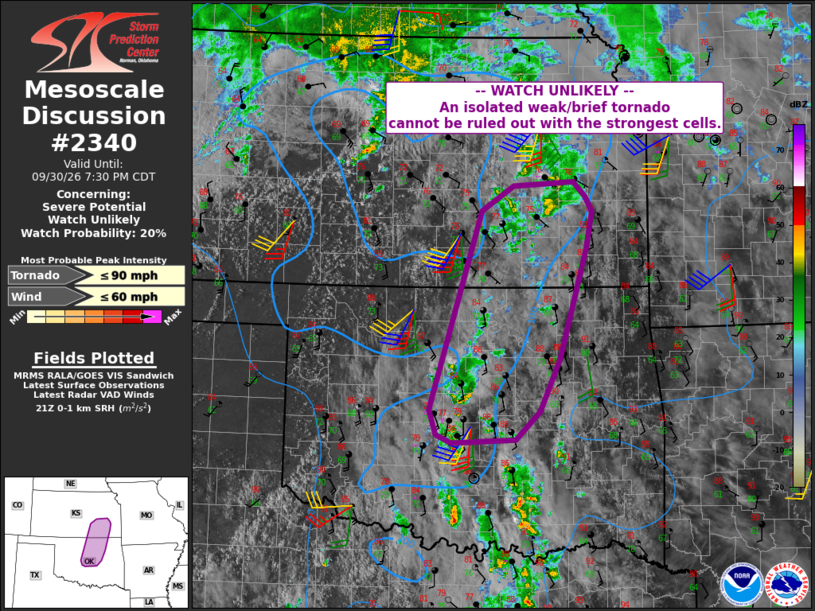
   Areas affected...parts of northern Oklahoma into southeast Kansas

   Concerning...Severe potential...Watch unlikely

   Valid 302200Z - 010030Z

   Probability of Watch Issuance...20 percent

   SUMMARY...Scattered storms may persist from parts of central into
   northern Oklahoma and southeast Kansas. A storm or two may exhibit
   rotation with a brief/weak tornado not out of the question.

   DISCUSSION...Scattered storms have developed within within the warm
   sector from northern TX across central OK, with additional activity
   extending into east-central KS. While the primary large-scale lift
   will remain to the north of these areas, south/southwest 850 mb
   winds are forecast to increase to over 40 kt this evening.
   Currently, the TLX VWP shows 0-1 SRH around 125 m2/s2, with larger
   values farther north to 300 m2/s2 at ICT.

   Given a few hours of scattered storms within this corridor, and
   areas of stronger low-level shear (especially into KS), a brief
   tornado cannot be ruled out if a more robust cell can develop.

   ..Jewell/Hart.. 09/30/2026

   ...Please see www.spc.noaa.gov for graphic product...

   ATTN...WFO...TSA...TOP...ICT...OUN...

   LAT...LON   35529789 37929712 38219663 38279574 38089556 37919546
               37469555 36149594 35509625 35169661 35139755 35239778
               35529789

   MOST PROBABLE PEAK TORNADO INTENSITY...UP TO 90 MPH
   MOST PROBABLE PEAK WIND GUST...UP TO 60 MPH
|
|
|
Top/All Mesoscale Discussions/Forecast Products/Home |
|
Source link