

| Mesoscale Discussion 2329 | |
| < Previous MD | |

|
|
   Mesoscale Discussion 2329
   NWS Storm Prediction Center Norman OK
   0627 PM CDT Sun Sep 27 2026

   Areas affected...Parts of the NE Sand Hills region

   Concerning...Severe potential...Watch unlikely

   Valid 272327Z - 280100Z

   Probability of Watch Issuance...20 percent

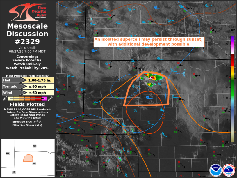
   SUMMARY...An isolated supercell may continue through sunset, with
   additional development possible.

   DISCUSSION...A nearly stationary supercell is ongoing across
   west-central Cherry County Nebraska this evening. While deep-layer
   flow/shear is generally rather modest, locally enhanced effective
   SRH near a surface boundary is likely helping to sustain this
   supercell, within a moderately unstable environment. MRMS data
   suggest that this cell is likely producing severe hail, and it will
   continue to pose a hail threat and potential for locally strong
   gusts for as long as it persists. 0-1 km SRH of 100-150 m2/s2 may
   also be sufficient for a brief tornado threat.

   This storm has generally remained nearly stationary, but some slow
   southward propagation will be possible for as long as it persists.
   Other recent development has been noted across western Cherry
   County. While uncertain, this additional development within a
   favorable environment could eventually evolve into a supercell as
   well, or help to maintain the dominant supercell through cell
   mergers. The ongoing surface-based storms should generally begin to
   weaken near/after dusk, as MLCINH begins to increase with nocturnal
   cooling.

   ..Dean/Hart.. 09/27/2026

   ...Please see www.spc.noaa.gov for graphic product...

   ATTN...WFO...LBF...

   LAT...LON   42690186 42640139 42540107 42190097 41810101 41790148
               41780260 42230244 42450228 42690186

   MOST PROBABLE PEAK TORNADO INTENSITY...UP TO 90 MPH
   MOST PROBABLE PEAK WIND GUST...UP TO 60 MPH
   MOST PROBABLE PEAK HAIL SIZE...1.00-1.75 IN
|
|
|
Top/All Mesoscale Discussions/Forecast Products/Home |
|
Source link