

| Mesoscale Discussion 2314 | |
| < Previous MD | |

|
|
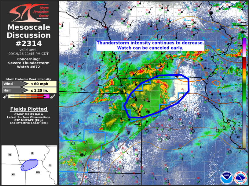
Mesoscale Discussion 2314 NWS Storm Prediction Center Norman OK 1043 PM CDT Sat Sep 19 2026 Areas affected...far northeast Kansas and portions of northern Missouri Concerning...Severe Thunderstorm Watch 672... Valid 200343Z - 200445Z The severe weather threat for Severe Thunderstorm Watch 672 continues. SUMMARY...Thunderstorm intensity continues to wane this evening as overall coverage of precipitation increases. The severe threat is not likely to recover and Severe Thunderstorm Watch #672 is likely to be canceled early. DISCUSSION...Ongoing showers and thunderstorms will continue across portions of northeast Kansas and northern Missouri this evening and into the morning hours. Despite a favorable thermodynamic environment, a cooling boundary layer, weakening lapse rates, and increasing widespread precipitation should limit the overall severe potential going forward. Evidence for this trend can be found in the overall slow warming of the convective complex cloud tops. Although brief gusty wind or perhaps small hail cannot be ruled out, Severe Thunderstorm Watch #672 is likely to be canceled early. ..Marsh.. 09/20/2026 ...Please see www.spc.noaa.gov for graphic product... ATTN...WFO...LSX...DVN...DMX...EAX...TOP... LAT...LON 39119459 39119522 39559546 40029515 40409465 40709379 40729269 40559233 40119233 39669285 39299386 39119459 MOST PROBABLE PEAK WIND GUST...UP TO 60 MPH MOST PROBABLE PEAK HAIL SIZE...UP TO 1.25 IN |
|
|
Top/All Mesoscale Discussions/Forecast Products/Home |
|
Source link