

| Mesoscale Discussion 2159 | |
| < Previous MD | |

|
|
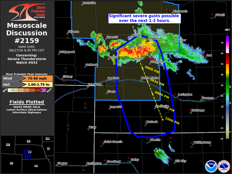
Mesoscale Discussion 2159 NWS Storm Prediction Center Norman OK 0747 PM CDT Thu Aug 27 2026 Areas affected...portions of central Nebraska Concerning...Severe Thunderstorm Watch 633... Valid 280047Z - 280145Z The severe weather threat for Severe Thunderstorm Watch 633 continues. SUMMARY...An organizing bowing cluster may produce significant severe gusts (75-90 mph) as it moves toward the I-80 corridor over the next 1-2 hours. DISCUSSION...A cluster of formerly HP supercells over central NE has merged and started to organize into a linear complex over the last 30 min. Recent KLNX radar data shows a developing weak reflectively notch concurrent with increasing outbound velocities of 70+ kt at 1-2 kft AGL. This is suggestive of a rapidly organizing cold pool and rear inflow jet. Given the favorable environment with MLCAPE in excess of 3000 J/kg and T/TD spreads of 20+ degrees F, significant damaging wind potential is likely increasing. Severe gusts of 75-90+ mph will be possible near the apex of the bowing cluster as it moves toward the I-80 corridor over the next hour. If the cluster is able to persist, a small downstream watch could be needed south of WW633 ..Lyons.. 08/28/2026 ...Please see www.spc.noaa.gov for graphic product... ATTN...WFO...GID...LBF...GLD... LAT...LON 41770147 42080082 41980032 41750020 41200001 40379981 40049983 39900043 39910084 40030107 40920145 41150142 41770147 MOST PROBABLE PEAK WIND GUST...75-90 MPH MOST PROBABLE PEAK HAIL SIZE...1.00-1.75 IN |
|
|
Top/All Mesoscale Discussions/Forecast Products/Home |
|
Source link