

| Mesoscale Discussion 2157 | |
| < Previous MD | |
|
|
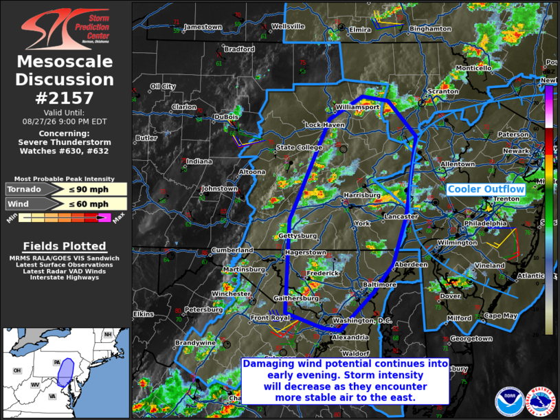
Mesoscale Discussion 2157 NWS Storm Prediction Center Norman OK 0626 PM CDT Thu Aug 27 2026 Areas affected...Central Pennsylvania into central Maryland Concerning...Severe Thunderstorm Watch 630...632... Valid 272326Z - 280100Z The severe weather threat for Severe Thunderstorm Watch 630, 632 continues. SUMMARY...Strong to severe storms from near DC/Baltimore into central/eastern Pennsylvania will pose a risk of wind damage into early evening. DISCUSSION...The strongest storm activity in the Mid-Atlantic region resides within an axis of greater buoyancy in parts of central Pennsylvania/Maryland. To the east of these storms, convectively modified outflow is present across much of New Jersey with similarly poor thermodynamics in the DelMarVa owing to persistent stratus today. The strongest activity will remain capable of isolated wind damage. A small linear segment--with a history of wind damage reports--moving towards the I-95 corridor in the DC/Baltimore vicinity will pose the greatest risk for wind damage over the next hour or so. With time, storms will eventually interact with more stable air to the east and a gradual weakening trend will likely occur at that time. ..Wendt.. 08/27/2026 ...Please see www.spc.noaa.gov for graphic product... ATTN...WFO...PHI...BGM...CTP...LWX... LAT...LON 39567616 39337637 39267642 38847690 38867714 39037769 40047764 41157706 41417658 41357622 40977581 40087597 39567616 MOST PROBABLE PEAK TORNADO INTENSITY...UP TO 90 MPH MOST PROBABLE PEAK WIND GUST...UP TO 60 MPH |
|
|
Top/All Mesoscale Discussions/Forecast Products/Home |
|
Source link