

| Mesoscale Discussion 2124 | |
| < Previous MD | |
|
|
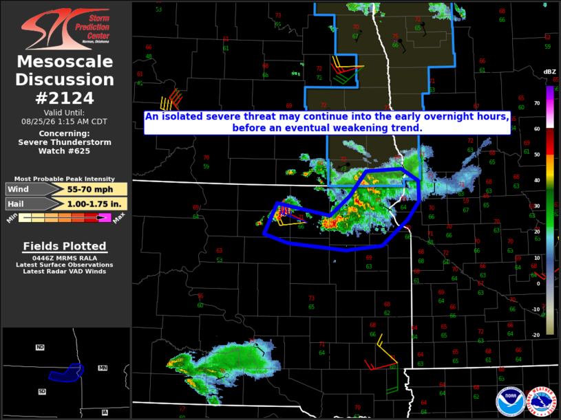
Mesoscale Discussion 2124 NWS Storm Prediction Center Norman OK 1149 PM CDT Mon Aug 24 2026 Areas affected...Northeast SD into a small part of southeast ND and west-central MN Concerning...Severe Thunderstorm Watch 625... Valid 250449Z - 250615Z The severe weather threat for Severe Thunderstorm Watch 625 continues. SUMMARY...An isolated severe threat may continue into the early morning hours, before an eventual weakening trend. DISCUSSION...An isolated elevated supercell has recently intensified to the west-northwest of Aberdeen. In the short term, MUCAPE of around 2000 J/kg and sufficient deep-layer shear will continue to support a threat of hail and localized severe gusts with this cell. To the east, a longer-lived storm cluster is moving across northeast SD. While this cluster has shown some signs of weakening, localized strong/damaging gusts cannot be ruled out as this cluster approaches the SD/ND/MN border region. With time, decreasing MUCAPE and increasing CINH with eastward extent should tend to result in a general weakening trend overnight, though localized hail and gusty winds may continue until convection subsides. ..Dean.. 08/25/2026 ...Please see www.spc.noaa.gov for graphic product... ATTN...WFO...FGF...ABR... LAT...LON 45709897 45539797 45809760 46139728 46169662 45999630 45729629 45499649 45149699 45089766 45169874 45299920 45709897 MOST PROBABLE PEAK WIND GUST...55-70 MPH MOST PROBABLE PEAK HAIL SIZE...1.00-1.75 IN |
|
|
Top/All Mesoscale Discussions/Forecast Products/Home |
|
Source link