

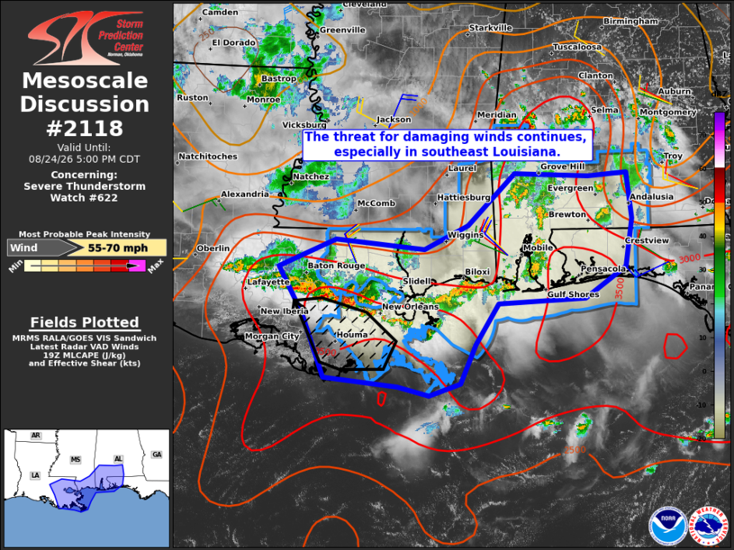
| Mesoscale Discussion 2118 | |
| < Previous MD | |

|
|
Mesoscale Discussion 2118 NWS Storm Prediction Center Norman OK 0257 PM CDT Mon Aug 24 2026 Areas affected...southeast Louisiana...far southeast Mississippi...southwest Alabama...and the western Florida Panhandle Concerning...Severe Thunderstorm Watch 622... Valid 241957Z - 242200Z The severe weather threat for Severe Thunderstorm Watch 622 continues. SUMMARY...The threat for damaging winds continues, especially in southeast Louisiana where an organized cold pool has developed. DISCUSSION...As of 1955Z, mosaic radar imagery showed a broken band of strong to severe storms from near Mobile west along the MS coast through New Orleans to south of Baton Rouge. The western segment of the thunderstorm band from St. John the Baptist to Ascension and St. James Parishes has developed an organized cold pool with updrafts exhibiting some forward-propagational characteristics, suggestive of an enhanced damaging wind threat. There, severe gusts up to 65 mph appear possible as that segment of storms continues south toward the coast. Elsewhere, expect the damaging wind threat to be more sporadic in nature through mid to late afternoon. ..Mead.. 08/24/2026 ...Please see www.spc.noaa.gov for graphic product... ATTN...WFO...MOB...LIX...LCH... LAT...LON 29929119 30529154 30879072 30748944 31058880 31698813 31668706 31698650 31118643 30518652 30138711 30068837 29568870 29068891 28918937 29028982 29139087 29929119 MOST PROBABLE PEAK WIND GUST...55-70 MPH |
|
|
Top/All Mesoscale Discussions/Forecast Products/Home |
|
Source link