

| Mesoscale Discussion 2110 | |
| < Previous MD | |

|
|
   Mesoscale Discussion 2110
   NWS Storm Prediction Center Norman OK
   0927 PM CDT Sun Aug 23 2026

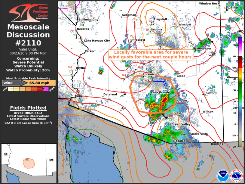
   Areas affected...Parts of south-central Arizona

   Concerning...Severe potential...Watch unlikely

   Valid 240227Z - 240400Z

   Probability of Watch Issuance...20 percent

   SUMMARY...A localized risk of severe wind gusts will persist for the
   next couple hours.

   DISCUSSION...A loosely organized cluster of thunderstorms is
   tracking northwestward across parts of south-central AZ -- southeast
   of the Phoenix metro. Meanwhile, an outflow boundary is moving
   southward toward this cluster. The ongoing cluster of storms and
   potential outflow collision will promote a locally favorable
   corridor for severe wind gusts -- given temperatures in the 100-105F
   range and very steep low-level lapse rates.

   ..Weinman/Thompson.. 08/24/2026

   ...Please see www.spc.noaa.gov for graphic product...

   ATTN...WFO...TWC...PSR...

   LAT...LON   32311123 32281182 32341218 32841243 33111252 33441235
               33531172 33351103 32851075 32471089 32311123

   MOST PROBABLE PEAK WIND GUST...65-80 MPH
|
|
|
Top/All Mesoscale Discussions/Forecast Products/Home |
|
Source link