

| Mesoscale Discussion 2108 | |
| < Previous MD | |
|
|
   Mesoscale Discussion 2108
   NWS Storm Prediction Center Norman OK
   0702 PM CDT Sun Aug 23 2026

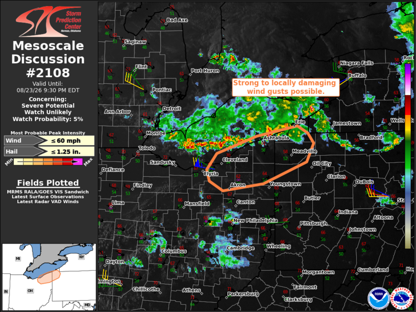
   Areas affected...Parts of northeastern Ohio and northwestern
   Pennsylvania

   Concerning...Severe potential...Watch unlikely

   Valid 240002Z - 240130Z

   Probability of Watch Issuance...5 percent

   SUMMARY...A couple strong to locally damaging wind gusts will be
   possible during the next hour or two.

   DISCUSSION...A loosely organized band of thunderstorms is tracking
   southeastward across Lake Erie -- ahead of a midlevel vort max
   rotating around a deep upper low over southeastern Ontario. While
   cool surface temperatures downstream may limit the overall severe
   risk, steepened low-level lapse rates, enhanced unidirectional
   low/midlevel flow, and the strengthening cold pool may support a
   couple strong to locally damaging wind gusts across parts of
   northeastern OH and northwestern PA.

   ..Weinman/Thompson.. 08/24/2026

   ...Please see www.spc.noaa.gov for graphic product...

   ATTN...WFO...PBZ...CLE...

   LAT...LON   41398201 41658179 41958092 42118001 42007978 41827965
               41527981 41158076 41038165 41208196 41398201

   MOST PROBABLE PEAK WIND GUST...UP TO 60 MPH
   MOST PROBABLE PEAK HAIL SIZE...UP TO 1.25 IN
|
|
|
Top/All Mesoscale Discussions/Forecast Products/Home |
|
Source link