

| Mesoscale Discussion 2107 | |
| < Previous MD | |

|
|
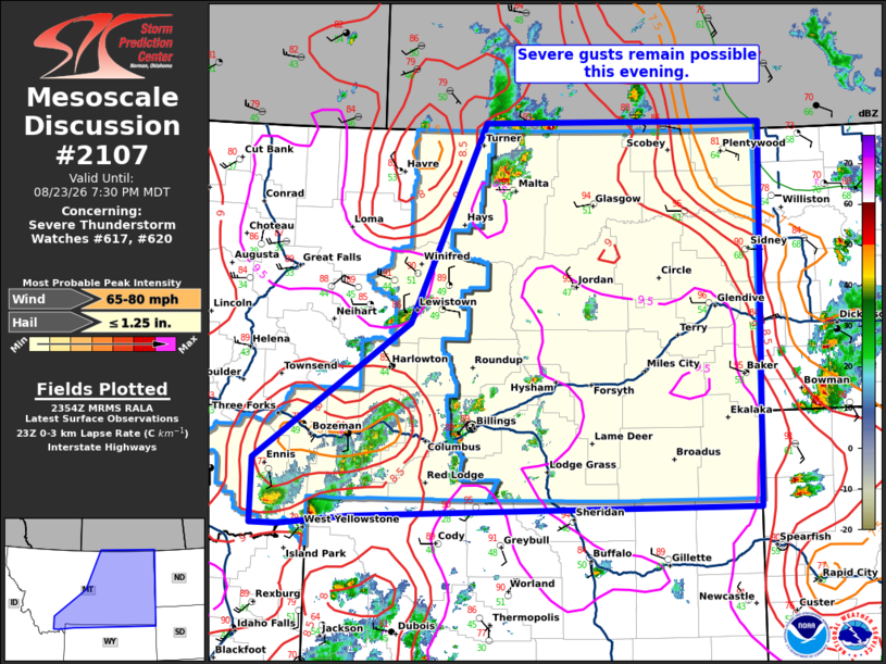
Mesoscale Discussion 2107 NWS Storm Prediction Center Norman OK 0656 PM CDT Sun Aug 23 2026 Areas affected...portions of Montana Concerning...Severe Thunderstorm Watch 617...620... Valid 232356Z - 240130Z The severe weather threat for Severe Thunderstorm Watch 617, 620 continues. SUMMARY...Severe gusts remain possible across portions of MT this evening. Ongoing storms may gradually evolve into a linear or cluster or two later this evening. DISCUSSION...Across WW 617 and 620, several clusters of strong to severe storms remain ongoing this evening. The air mass downstream is hot and sufficiently unstable to support the ongoing storms. Some CAM guidance and radar trends suggest some upscale growth into one or more clusters is possible this evening. This appears most likely across northern portions of MT where more robust convection is ongoing. Stronger vertical shear may also support better organization of these storms with time. With steep lapse rates in the lowest several km, severe gusts remain likely this evening. ..Lyons.. 08/23/2026 ...Please see www.spc.noaa.gov for graphic product... ATTN...WFO...BIS...UNR...BYZ...GGW...RIW...TFX...PIH... LAT...LON 45401191 46910951 49070834 49070393 44900404 44801039 44691149 44691192 45401191 MOST PROBABLE PEAK WIND GUST...65-80 MPH MOST PROBABLE PEAK HAIL SIZE...UP TO 1.25 IN |
|
|
Top/All Mesoscale Discussions/Forecast Products/Home |
|
Source link