

| Mesoscale Discussion 2105 | |
| < Previous MD | |

|
|
   Mesoscale Discussion 2105
   NWS Storm Prediction Center Norman OK
   0449 PM CDT Sun Aug 23 2026

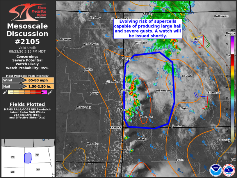
   Areas affected...Parts of southwestern North Dakota

   Concerning...Severe potential...Watch likely

   Valid 232149Z - 232315Z

   Probability of Watch Issuance...95 percent

   SUMMARY...The risk of supercells and organized clusters capable of
   producing large hail and severe wind gusts will increase over the
   next few hours. A watch will be issued shortly.

   DISCUSSION...Thunderstorms are evolving along a lee trough in far
   southwestern ND -- potentially being aided by a passing midlevel
   wave farther north (evident in WV imagery). An elongated hodograph
   with clockwise curvature (around 30-40 kt of effective shear) and
   steep midlevel lapse rates atop lower/middle 60s dewpoints will
   support organized clusters and supercell structures capable of
   producing large to very large hail and severe wind gusts. Deep-layer
   shear oriented perpendicular to the lee trough will initially favor
   discrete cells, though localized upscale growth into small clusters
   is possible with time. A watch will be issued shortly.

   ..Weinman/Thompson.. 08/23/2026

   ...Please see www.spc.noaa.gov for graphic product...

   ATTN...WFO...BIS...UNR...

   LAT...LON   46170398 47120400 47640394 47870360 47950260 47670210
               46610204 46040230 45910282 45970382 46170398

   MOST PROBABLE PEAK WIND GUST...65-80 MPH
   MOST PROBABLE PEAK HAIL SIZE...1.50-2.50 IN
|
|
|
Top/All Mesoscale Discussions/Forecast Products/Home |
|
Source link