

| Mesoscale Discussion 2089 | |
| < Previous MD | |
|
|
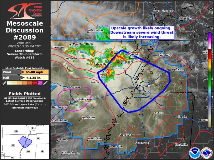
Mesoscale Discussion 2089 NWS Storm Prediction Center Norman OK 0333 PM CDT Sat Aug 22 2026 Areas affected...Northeast Arkansas into western Tennessee and far northwest Mississippi Concerning...Severe Thunderstorm Watch 615... Valid 222033Z - 222230Z The severe weather threat for Severe Thunderstorm Watch 615 continues. SUMMARY...The early signs up upscale growth are noted across northeast Arkansas, hinting that the potential for severe winds is likely increasing downstream into western Tennessee and far northwest Mississippi. DISCUSSION...Over the past 40-45 minutes, reflectivity and velocity data from KLZK and KNQA have shown the early stages of semi-discrete cells merging and growing upscale into a more cohesive convective cluster. Cold pool amalgamation appears to be ongoing with embedded swaths of more intense wind now evident in KNQA velocity imagery. Downstream of this developing cluster, low-level lapse rates have steepened to 8-9 C/km as temperatures climb into the upper 90s. Additionally, the KNQA VWP is sampling 0-6 km BWD values on the order of 30-35 knots. Both of these factors will continue to favor organization and intensification of the emerging cluster (possibly into a more coherent linear structure) as it spreads southeast into western TN and far northwest MS over the next two hours. Based on recent convective trends, the downstream environment, and output from recent CAM guidance (which appear to be capturing ongoing trends well) the potential for 60-80 mph winds will likely increase as the cluster/line approaches the I-40 corridor. ..Moore.. 08/22/2026 ...Please see www.spc.noaa.gov for graphic product... ATTN...WFO...MEG...LZK... LAT...LON 35058917 34658977 34509004 34439039 34569063 35429141 35589146 35699121 35939100 36139078 36229062 35578897 35318893 35058917 MOST PROBABLE PEAK WIND GUST...65-80 MPH MOST PROBABLE PEAK HAIL SIZE...UP TO 1.25 IN |
|
|
Top/All Mesoscale Discussions/Forecast Products/Home |
|
Source link