

| Mesoscale Discussion 2078 | |
| < Previous MD | |
|
|
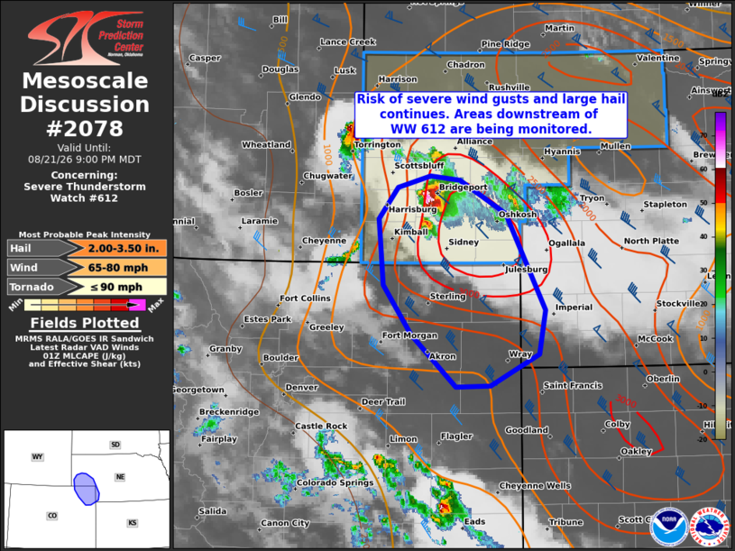
Mesoscale Discussion 2078 NWS Storm Prediction Center Norman OK 0832 PM CDT Fri Aug 21 2026 Areas affected...Parts of the southern Nebraska Panhandle into northeastern Colorado Concerning...Severe Thunderstorm Watch 612... Valid 220132Z - 220300Z The severe weather threat for Severe Thunderstorm Watch 612 continues. SUMMARY...The risk of severe wind gusts and very large hail continues across parts of the Nebraska Panhandle this evening. The severe risk may spread south of Severe Thunderstorm Watch 612 into northeastern Colorado, and a downstream watch issuance is possible. DISCUSSION...A robust right-moving supercell has recently intensified in the NE Panhandle as it encounters a maximum in surface-based buoyancy, driven by a plume of upper 60s dewpoints and steep deep-layer lapse rates. Around 50-60 kt of effective shear will continue to support this storm with southward extent, posing a risk of very large hail (recent reports of baseball-sized hail) and severe wind gusts. Given the warm/moist air mass downstream into northeast CO, and the potential for storm mergers amid a gradually strengthening nocturnal LLJ, an organized cluster could persist/spread south of the watch, and trends are being monitored for a downstream watch. ..Weinman.. 08/22/2026 ...Please see www.spc.noaa.gov for graphic product... ATTN...WFO...LBF...GLD...BOU...CYS... LAT...LON 40320342 40790376 41420382 41710358 41830317 41790280 41460222 40550174 40130182 39830243 39820285 40320342 MOST PROBABLE PEAK TORNADO INTENSITY...UP TO 90 MPH MOST PROBABLE PEAK WIND GUST...65-80 MPH MOST PROBABLE PEAK HAIL SIZE...2.00-3.50 IN |
|
|
Top/All Mesoscale Discussions/Forecast Products/Home |
|
Source link