

| Mesoscale Discussion 2067 | |
| < Previous MD | |
|
|
   Mesoscale Discussion 2067
   NWS Storm Prediction Center Norman OK
   0110 PM CDT Fri Aug 21 2026

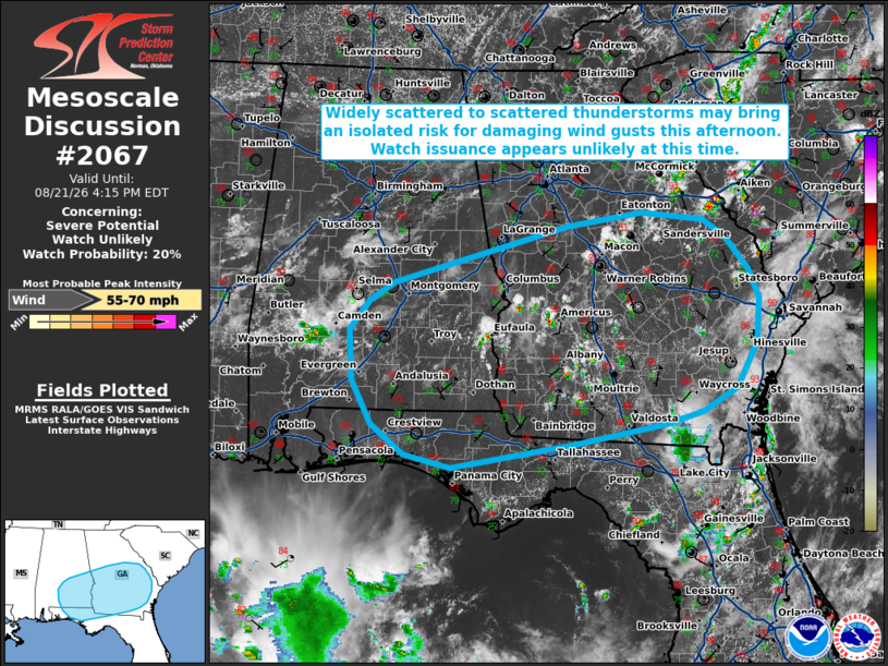
   Areas affected...portions of the central Gulf Coast into
   central/southern Georgia

   Concerning...Severe potential...Watch unlikely

   Valid 211810Z - 212015Z

   Probability of Watch Issuance...20 percent

   SUMMARY...Widely scattered to scattered thunderstorms may pose a
   risk for isolated damaging downburst wind gusts through this
   evening. Watch issuance appears unlikely at this time.

   DISCUSSION...Isolated thunderstorms are ongoing across west-central
   Alabama and southern Georgia as of 1800 UTC, with additional
   development expected along a remnant outflow boundary and within
   pockets of modestly enhanced surface convergence across the region
   through the afternoon. High PW (1.75-2.0+ inches) and steepening
   low-level lapse rates will foster at least an isolated risk for
   damaging wind gusts with water-loaded downbursts; however,
   marginally cooler temperatures (low 90s F) and modestly weaker
   low-to-mid level flow (less than 15-20 kts per area VWPs) suggest
   the coverage and magnitude of the severe risk may be somewhat more
   limited compared to areas farther west. Given this, the need for a
   Severe Thunderstorm Watch is more uncertain but appears unlikely at
   this time. Trends will continue to be monitored, and a watch could
   be considered should a corridor of greater damaging wind gust
   potential become evident.

   ..Chalmers/Smith.. 08/21/2026

   ...Please see www.spc.noaa.gov for graphic product...

   ATTN...WFO...CHS...CAE...JAX...FFC...TAE...BMX...MOB...

   LAT...LON   30618401 30338569 30488632 30828677 31338705 31938709
               32268681 32498648 33168410 33328308 33228222 33018191
               32638160 32308146 31788150 31268179 30998225 30838276
               30618401

   MOST PROBABLE PEAK WIND GUST...55-70 MPH
|
|
|
Top/All Mesoscale Discussions/Forecast Products/Home |
|
Source link