

| Mesoscale Discussion 2051 | |
| < Previous MD | |
|
|
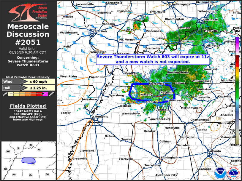
Mesoscale Discussion 2051 NWS Storm Prediction Center Norman OK 0526 AM CDT Thu Aug 20 2026 Areas affected...Western and Middle Tennessee Concerning...Severe Thunderstorm Watch 603... Valid 201026Z - 201130Z The severe weather threat for Severe Thunderstorm Watch 603 continues. SUMMARY...Severe Thunderstorm Watch 603 will expire at 11z, and a new watch is not expected. DISCUSSION...Widespread thunderstorms and stratiform precipitation continue across portions of western and Middle Tennessee at 1020z. Substantial convective overturning and weakening low-level warm advection have led to generally diminished intensities over most of the remaining watch area since 09z. Although an occasionally stronger storm will remain possible over the next 1-2 hours over western and Middle TN in proximity to a modestly veering low-level jet, current and expected short-term convective trends should preclude the need for a new watch. ..Bunting.. 08/20/2026 ...Please see www.spc.noaa.gov for graphic product... ATTN...WFO...OHX...PAH...MEG... LAT...LON 36598816 36628677 36528627 36208605 35978608 35878644 35838678 35878720 35928750 35948779 36008819 36188831 36598816 MOST PROBABLE PEAK WIND GUST...UP TO 60 MPH MOST PROBABLE PEAK HAIL SIZE...UP TO 1.25 IN |
|
|
Top/All Mesoscale Discussions/Forecast Products/Home |
|
Source link