

| Mesoscale Discussion 2018 | |
| < Previous MD | |
|
|
   Mesoscale Discussion 2018
   NWS Storm Prediction Center Norman OK
   0604 PM CDT Mon Aug 17 2026

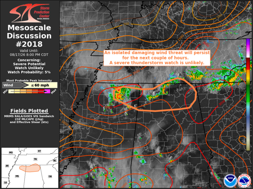
   Areas affected...Northern Mississippi/Alabama into Southern Middle
   Tennessee

   Concerning...Severe potential...Watch unlikely

   Valid 172304Z - 180100Z

   Probability of Watch Issuance...5 percent

   SUMMARY...Isolated damaging wind gusts are possible into the
   evening.  The severe wind threat is expected to remain too isolated
   for watch issuance.

   DISCUSSION...Numerous thunderstorms have developed along a surface
   boundary across the region with over 3000 J/kg of MLCAPE (per
   RAP-based mesoanalysis).  Although these storms are developing in a
   weak-shear environment, the thermodynamic environment supports a
   threat of wet microbursts.  As these storms pulse up and
   subsequently collapse, damaging wind gusts will be possible over the
   next couple of hours.  Cold-pool clustering, as storms push to the
   southeast, may enhance the damaging wind threat.  Given the isolated
   spatiotemporal severe-weather threat (ending shortly after dark), a
   severe-thunderstorm watch is unlikely.

   ..Jirak/Gleason.. 08/17/2026

   ...Please see www.spc.noaa.gov for graphic product...

   ATTN...WFO...OHX...BMX...HUN...MEG...

   LAT...LON   34718928 34878887 34788801 34808752 35048698 35208640
               35128611 34868574 34658558 34378562 34088589 34038630
               33978743 33998815 34298893 34408926 34718928

   MOST PROBABLE PEAK WIND GUST...UP TO 60 MPH
|
|
|
Top/All Mesoscale Discussions/Forecast Products/Home |
|
Source link