

| Mesoscale Discussion 2015 | |
| < Previous MD | |
|
|
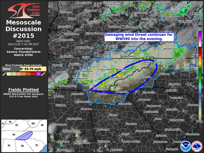
Mesoscale Discussion 2015 NWS Storm Prediction Center Norman OK 0449 PM CDT Mon Aug 17 2026 Areas affected...Eastern Tennessee into Western North Carolina Concerning...Severe Thunderstorm Watch 590... Valid 172149Z - 172345Z The severe weather threat for Severe Thunderstorm Watch 590 continues. SUMMARY...The threat for damaging winds will continue over the next few hours as storms cluster across the area. DISCUSSION...The development of numerous storms in a moist, unstable environment in the lee of the Appalachians have slowly clustered and grown upscale this afternoon. Within a modestly favorable low-level westerly shear environment (i.e., 0-3 km shear around 20-25 knots per mesoanalysis and local VWPs), continued upscale growth and organization is likely over the next few hours. As such, the threat for damaging winds will persist as multiple clusters progress eastward toward the higher terrain. ..Jirak.. 08/17/2026 ...Please see www.spc.noaa.gov for graphic product... ATTN...WFO...RNK...GSP...MRX...FFC... LAT...LON 35058544 35468475 35818397 36248316 36498231 36528187 36408154 36118147 35778174 35398223 35028285 34858357 34938437 34908468 35058544 MOST PROBABLE PEAK WIND GUST...55-70 MPH |
|
|
Top/All Mesoscale Discussions/Forecast Products/Home |
|
Source link