

| Mesoscale Discussion 2014 | |
| < Previous MD Next MD > | |

|
|
   Mesoscale Discussion 2014
   NWS Storm Prediction Center Norman OK
   0437 PM CDT Mon Aug 17 2026

   Areas affected...portions of central and eastern Montana

   Concerning...Severe potential...Watch unlikely

   Valid 172137Z - 172300Z

   Probability of Watch Issuance...20 percent

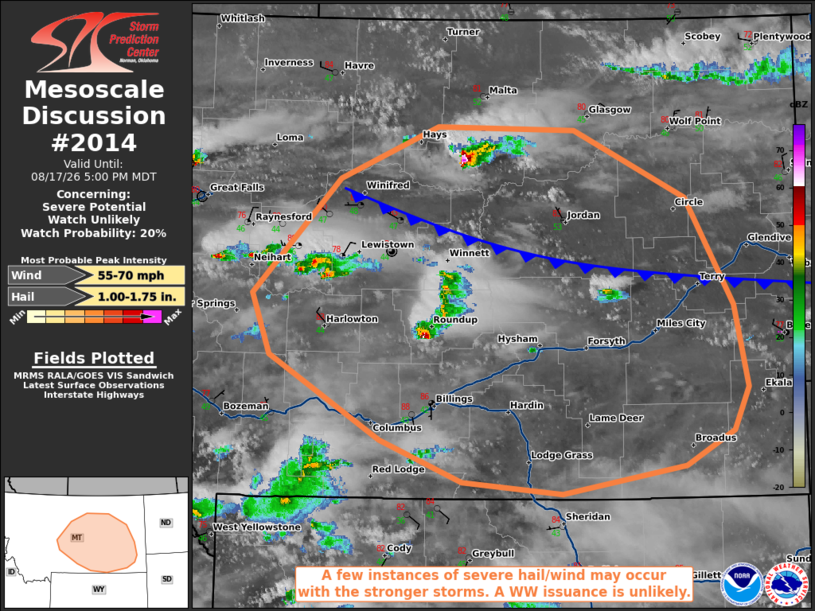
   SUMMARY...A few brief instances of severe gusts or large hail may
   occur with the stronger, sustained storms through the evening hours.
   A WW issuance is not expected given the anticipated isolated nature
   of the severe threat.

   DISCUSSION...Multiple multicells and a supercell have developed
   ahead and behind a southward-sagging surface cold front over central
   and eastern MT, which is being overspread by a 300 mb jet streak and
   500 mb impulse. Given the aforementioned upper support, these storms
   are expected to persist into the evening. 21Z mesoanalysis shows
   steep tropospheric lapse rates in place, along with 40+ kts of
   effective bulk shear. MRMS mosaic radar data suggests that severe
   hail may already be falling with some of these storms, and the
   aforementioned instability/vertical wind shear should support
   continued severe wind/hail potential for at least a few hours. Total
   buoyancy is limited however, so the severe threat should remain on
   the sparse end, with a WW issuance currently not expected.

   ..Squitieri/Gleason.. 08/17/2026

   ...Please see www.spc.noaa.gov for graphic product...

   ATTN...WFO...BYZ...GGW...TFX...

   LAT...LON   46701070 47660966 48100847 48070680 47500544 46610488
               45910472 45560490 45260548 45040695 45140816 45480915
               46181049 46701070

   MOST PROBABLE PEAK WIND GUST...55-70 MPH
   MOST PROBABLE PEAK HAIL SIZE...1.00-1.75 IN
|
|
|
Top/All Mesoscale Discussions/Forecast Products/Home |
|
Source link