

| Mesoscale Discussion 2008 | |
| < Previous MD | |
|
|
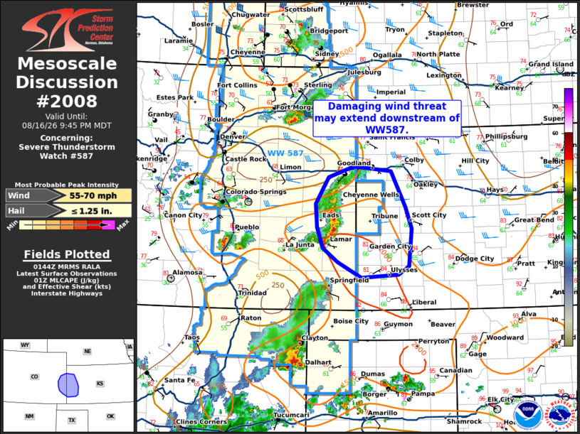
Mesoscale Discussion 2008 NWS Storm Prediction Center Norman OK 0846 PM CDT Sun Aug 16 2026 Areas affected...eastern Colorado into western Kansas Concerning...Severe Thunderstorm Watch 587... Valid 170146Z - 170345Z The severe weather threat for Severe Thunderstorm Watch 587 continues. SUMMARY...Damaging wind potential may extend downstream of WW587. DISCUSSION...A loosely organized cluster continues to drift southeastward out of eastern Colorado this evening. There is some uncertainty to the maintenance of this cluster downstream into Kansas. Temperatures across western Kansas remain warm in the upper 70s to 80s with dew points in the low to mid 60s. 00z RAOB from DDC sampled MLCAPE around 1100 J/kg but also fairly warm air around 700 mb. It is possible that with the loss of daytime heating, storms may struggle with eastward extent given the warmer air aloft. This area will be monitored but downstream watch issuance remains low confidence at this time. Local watch extension of WW587 may be needed. ..Thornton/Gleason.. 08/17/2026 ...Please see www.spc.noaa.gov for graphic product... ATTN...WFO...DDC...GLD...PUB... LAT...LON 37580116 37530193 37780243 38010274 38350285 38750289 39190261 39360208 39280130 38690101 38340087 37710094 37580116 MOST PROBABLE PEAK WIND GUST...55-70 MPH MOST PROBABLE PEAK HAIL SIZE...UP TO 1.25 IN |
|
|
Top/All Mesoscale Discussions/Forecast Products/Home |
|
Source link