

| Mesoscale Discussion 2003 | |
| < Previous MD | |
|
|
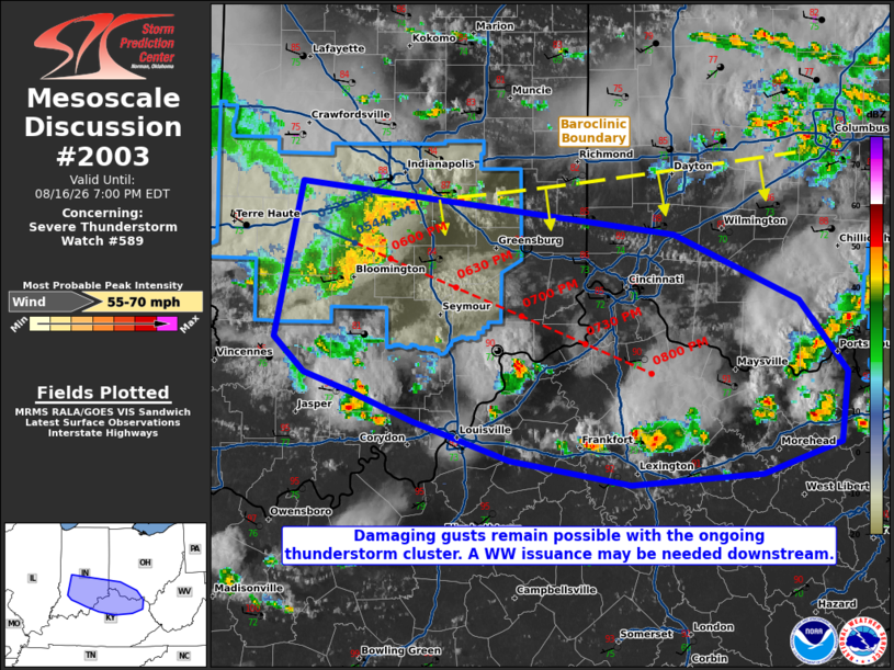
Mesoscale Discussion 2003 NWS Storm Prediction Center Norman OK 0500 PM CDT Sun Aug 16 2026 Areas affected...portions of southern Indiana into southwestern Ohio and northern Kentucky Concerning...Severe Thunderstorm Watch 589... Valid 162200Z - 162300Z The severe weather threat for Severe Thunderstorm Watch 589 continues. SUMMARY...Damaging gusts (a couple of which may be severe) remain possible with an ongoing thunderstorm cluster over the next few hours. Storms may progress beyond the bounds of Severe Thunderstorm Watch 589, which may require a new watch issuance downstream. DISCUSSION...A cold-pool-driven MCS continues to rapidly progress southeastward at around 45-50 kts across central and southern IN. While wind damage/gust reports have not recently been received, the MCS is preceded by 1500-3000 J/kg MLCAPE and 20-30 kts of effective bulk shear. While the deep-layer shear is relatively weak, the well-established cold pool with this MCS continues to propagate along a southward-sagging baroclinic boundary, possibly supporting tilting of modest localized horizontal vorticity in place. Assuming this is the case, it is plausible that the MCS may maintain intensity for at least a few more hours. Should this occur, the MCS will propagate past the bounds of Severe Thunderstorm Watch 589 with a damaging/severe gust threat. If this scenario becomes more apparent, a downstream Severe Thunderstorm Watch will be considered. ..Squitieri/Gleason.. 08/16/2026 ...Please see www.spc.noaa.gov for graphic product... ATTN...WFO...RLX...JKL...ILN...LMK...IND... LAT...LON 39718689 39408418 39028326 38618292 38228297 38038353 37988450 38118537 38348608 38508653 38618687 38828710 39718689 MOST PROBABLE PEAK WIND GUST...55-70 MPH |
|
|
Top/All Mesoscale Discussions/Forecast Products/Home |
|
Source link