

| Mesoscale Discussion 1994 | |
| < Previous MD | |
|
|
   Mesoscale Discussion 1994
   NWS Storm Prediction Center Norman OK
   0213 AM CDT Sun Aug 16 2026

   Areas affected...Parts of northern KS and southern NE into northwest
   MO

   Concerning...Severe potential...Watch unlikely

   Valid 160713Z - 160915Z

   Probability of Watch Issuance...20 percent

   SUMMARY...Strong to locally severe gusts are possible overnight.

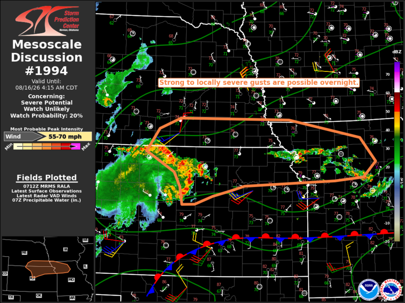
   DISCUSSION...An MCS is moving across north-central KS towards
   south-central NE early this morning. Relatively strong inbound
   velocities (45-55 kt) are noted at 1-2 km AGL from KUEX along the
   gust front, though recent measured gusts have generally been
   sub-severe. Low-level warm advection and a plume of large PW
   (near/above 2 inches) to the north of a front draped across southern
   KS may help to sustain this system through at least part of the
   overnight, though rather weak mid/upper-level flow, modest effective
   shear, and unfavorable low-level lapse rates may tend to keep any
   severe-gust threat localized.

   Additional storms may continue to develop in advance of the MCS
   across northeast KS into northwest MO, within the warm-advection
   regime north of the front. The large PW will support localized
   downburst potential within this regime as well, though the elevated
   nature of the convection and generally modest effective shear are
   expected to limit the coverage and magnitude of the threat.

   ..Dean/Mosier.. 08/16/2026

   ...Please see www.spc.noaa.gov for graphic product...

   ATTN...WFO...DMX...EAX...OAX...TOP...ICT...GID...

   LAT...LON   39889941 40409903 40669840 40629512 40189300 39629254
               39279292 39199378 39109646 38999687 38869741 38679794
               38669832 39079838 39419856 39889941

   MOST PROBABLE PEAK WIND GUST...55-70 MPH
|
|
|
Top/All Mesoscale Discussions/Forecast Products/Home |
|
Source link