

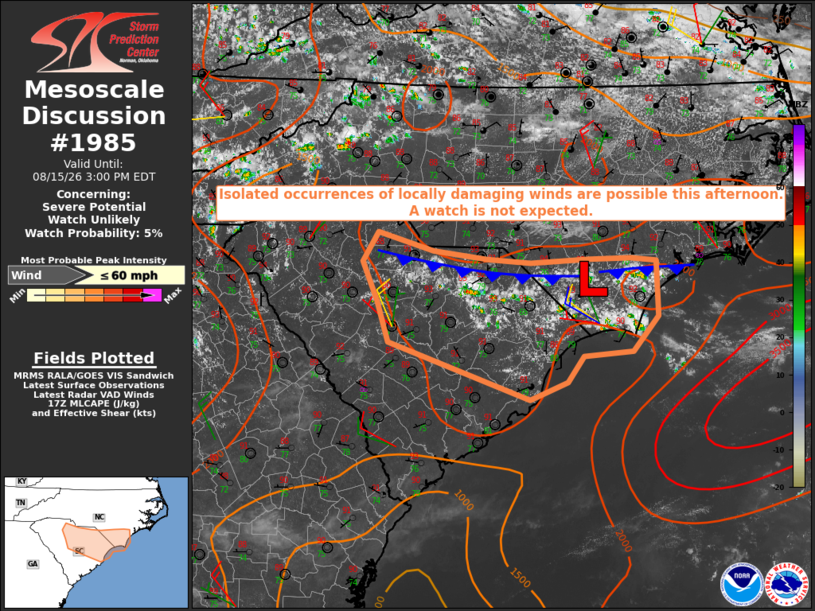
| Mesoscale Discussion 1985 | |
| < Previous MD | |

|
|
   Mesoscale Discussion 1985
   NWS Storm Prediction Center Norman OK
   1202 PM CDT Sat Aug 15 2026

   Areas affected...central and northeast South Carolina into southeast
   North Carolina

   Concerning...Severe potential...Watch unlikely

   Valid 151702Z - 151900Z

   Probability of Watch Issuance...5 percent

   SUMMARY...Isolated occurrences of locally damaging wind gusts appear
   possible this afternoon. The areal coverage of the threat is
   expected to remain too limited to warrant a watch issuance.

   DISCUSSION...Recent trends in visible satellite imagery indicate a
   deepening cumulus field and incipient thunderstorm development along
   and ahead of a weak front settling south through southeast NC and
   northern SC. Modification of the 12Z CHS sounding for current
   surface conditions yields a moderate to strongly unstable
   environment with MLCAPE of around 3000 J/kg. The air mass is quite
   moist with PW of around 2.4 inches, suggesting the likelihood for
   downdraft enhancement via water loading with an attendant risk for
   damaging wind gusts. Vertical shear is quite weak, which will limit
   the degree of storm organization and longevity, likely resulting in
   an isolated areal coverage of the severe risk.

   ..Mead/Guyer.. 08/15/2026

   ...Please see www.spc.noaa.gov for graphic product...

   ATTN...WFO...RAH...ILM...CHS...CAE...GSP...

   LAT...LON   34228131 34648150 34968130 34778058 34677987 34647932
               34687855 34697800 34657768 34067766 33687799 33627862
               33357883 33167932 33778116 34228131

   MOST PROBABLE PEAK WIND GUST...UP TO 60 MPH
|
|
|
Top/All Mesoscale Discussions/Forecast Products/Home |
|
Source link