

| Mesoscale Discussion 1959 | |
| < Previous MD | |

|
|
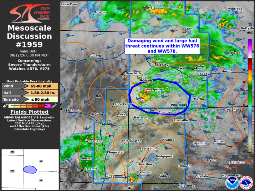
Mesoscale Discussion 1959 NWS Storm Prediction Center Norman OK 0534 PM CDT Wed Aug 12 2026 Areas affected...southwestern South Dakota into northern Nebraska Concerning...Severe Thunderstorm Watch 576...578... Valid 122234Z - 130030Z The severe weather threat for Severe Thunderstorm Watch 576, 578 continues. SUMMARY...Damaging wind and large hail threat continues within WW576 and WW578. DISCUSSION...A cluster of supercells continue southeastward across southwestern South Dakota. These have produced hail up to 1.75 inches in diameter and damaging wind up to 87 mph. These will likely continue to pose a risk for large hail and damaging wind downstream over the next few hours, given the very favorably unstable and deeply sheared environment across western Nebraska, where MLCAPE around 1000-2400 J/kg and deep layer shear around 45-50 kts is depicted by SPC Mesoanalyis. Trends in hi-res guidance suggest that this cluster may eventually interact with convection coming out of Colorado later this evening, with a continued damaging wind risk through the evening. ..Thornton.. 08/12/2026 ...Please see www.spc.noaa.gov for graphic product... ATTN...WFO...LBF...UNR...CYS... LAT...LON 42880340 43090396 43350404 43540393 43640366 43700343 43750298 43760295 43640232 43310183 43050191 42910202 42860217 42810234 42880340 MOST PROBABLE PEAK TORNADO INTENSITY...UP TO 90 MPH MOST PROBABLE PEAK WIND GUST...65-80 MPH MOST PROBABLE PEAK HAIL SIZE...1.50-2.50 IN |
|
|
Top/All Mesoscale Discussions/Forecast Products/Home |
|
Source link