

| Mesoscale Discussion 1917 | |
| < Previous MD | |

|
|
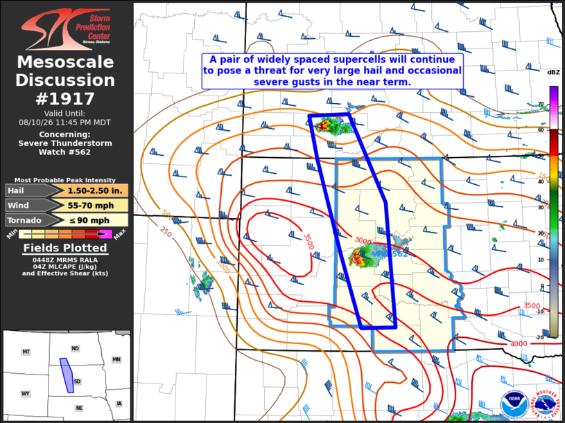
Mesoscale Discussion 1917 NWS Storm Prediction Center Norman OK 1150 PM CDT Mon Aug 10 2026 Areas affected...Parts of southwest ND into west-central SD Concerning...Severe Thunderstorm Watch 562... Valid 110450Z - 110545Z The severe weather threat for Severe Thunderstorm Watch 562 continues. SUMMARY...A pair of widely spaced supercells will continue to pose a threat for very large hail and occasional severe gusts in the near term. DISCUSSION...A reservoir of strong instability amid enhanced west-northwesterly mid-level flow and related 45-55 kt of deep-layer shear will continue to support a pair of widely spaced intense supercells across southwest ND into west-central SD. Current expectations are for these supecells to pose mainly a large to very large hail threat in the near term (up to 1.5-2.5 inches in diameter) given the presence of very steep mid-level lapse rates and strong cloud-layer shear noted on the 00Z observed sounding from UNR. These cells should continue tracking southeastward, with occasional severe downdraft gusts also possible given the ample MUCAPE present. The potential for upscale growth into a bowing cluster with this ongoing activity remains highly uncertain, as stronger low-level flow and warm/moist advection related to a gradually strengthening low-level jet will tend to focus to the south/east of this region (NE into IA). ..Gleason.. 08/11/2026 ...Please see www.spc.noaa.gov for graphic product... ATTN...WFO...ABR...BIS...UNR... LAT...LON 46580259 46610171 45270092 43350073 43340145 44460188 45920240 46580259 MOST PROBABLE PEAK TORNADO INTENSITY...UP TO 90 MPH MOST PROBABLE PEAK WIND GUST...55-70 MPH MOST PROBABLE PEAK HAIL SIZE...1.50-2.50 IN |
|
|
Top/All Mesoscale Discussions/Forecast Products/Home |
|
Source link