

| Mesoscale Discussion 1915 | |
| < Previous MD | |

|
|
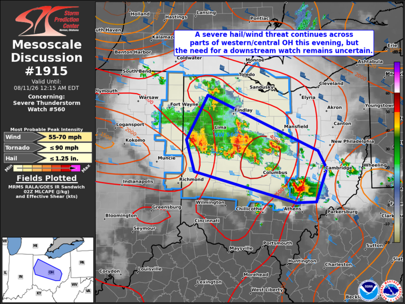
Mesoscale Discussion 1915 NWS Storm Prediction Center Norman OK 0952 PM CDT Mon Aug 10 2026 Areas affected...Parts of OH Concerning...Severe Thunderstorm Watch 560... Valid 110252Z - 110415Z The severe weather threat for Severe Thunderstorm Watch 560 continues. SUMMARY...A severe hail/wind threat continues this evening across parts of Ohio, but the need for a downstream watch remains uncertain. DISCUSSION...Two slow-moving clusters have become the primary severe risk this evening across western OH. While a very unstable airmass remains in place ahead of this activity (MLCAPE up to 3000-3500+ J/kg per recent mesoanalysis), a lack of recent wind reports suggests that these thunderstorms may be slightly elevated. Even so, modest low-level southwesterlies veering to west-northwesterly and gradually strengthening with height through mid levels will continue to foster around 30-35 kt of deep-layer shear (reference the 00Z ILN observed sounding). This should be sufficient for continued updraft organization, with occasional severe/damaging winds the primary threat given the ongoing cluster mode. Isolated hail also appears possible with embedded stronger cores. These clusters will spread east-southeastward this evening across central OH, and will eventually encounter a less unstable airmass into far eastern OH and WV, where prior convective overturning occurred earlier today. Therefore, the potential for organized severe convection persisting east of Severe Thunderstorm Watch 560 remains uncertain, as does the need for a downstream watch. ..Gleason.. 08/11/2026 ...Please see www.spc.noaa.gov for graphic product... ATTN...WFO...PBZ...RLX...CLE...ILN...IWX... LAT...LON 40578471 41368423 40398171 40078152 39498176 39488224 40038453 40578471 MOST PROBABLE PEAK TORNADO INTENSITY...UP TO 90 MPH MOST PROBABLE PEAK WIND GUST...55-70 MPH MOST PROBABLE PEAK HAIL SIZE...UP TO 1.25 IN |
|
|
Top/All Mesoscale Discussions/Forecast Products/Home |
|
Source link