

| Mesoscale Discussion 1902 | |
| < Previous MD | |

|
|
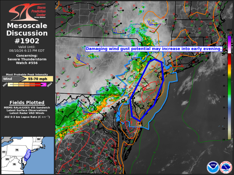
Mesoscale Discussion 1902 NWS Storm Prediction Center Norman OK 0319 PM CDT Mon Aug 10 2026 Areas affected...New York City vicinity through New Jersey into Delaware Concerning...Severe Thunderstorm Watch 556... Valid 102019Z - 102215Z The severe weather threat for Severe Thunderstorm Watch 556 continues. SUMMARY...The threat for damaging wind gusts may increase into early evening as storms approach the coast. DISCUSSION...So far this afternoon, thunderstorms in southeast NY and eastern PA have remained disorganized within a broader band of lower reflectivity, presumably due to poor lapse rate profiles. Ahead of the ongoing storms, temperatures have warmed into the mid 80s to lower 90s with latest objective analysis indicating a corridor of steeper low-level lapse rates, which may support some storm organization into early evening, given the presence of 35-40 kt of westerly deep-layer shear. ..Mead.. 08/10/2026 ...Please see www.spc.noaa.gov for graphic product... ATTN...WFO...OKX...PHI... LAT...LON 40307519 41067469 41167442 41047404 40327395 39317446 39077478 38697517 38867557 39547567 40307519 MOST PROBABLE PEAK WIND GUST...55-70 MPH |
|
|
Top/All Mesoscale Discussions/Forecast Products/Home |
|
Source link