

| Mesoscale Discussion 1893 | |
| < Previous MD | |
|
|
   Mesoscale Discussion 1893
   NWS Storm Prediction Center Norman OK
   0829 AM CDT Mon Aug 10 2026

   Areas affected...southeast Pennsylvania...northeast
   Maryland...northern Delaware...and southern New Jersey

   Concerning...Severe potential...Watch possible

   Valid 101329Z - 101500Z

   Probability of Watch Issuance...40 percent

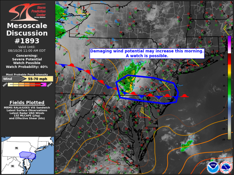
   SUMMARY...Damaging wind potential may increase with an ongoing MCS.
   Convective trends are being monitored for a possible severe
   thunderstorm watch.

   DISCUSSION...As of 1325Z, radar imagery showed a small MCS with a
   leading bow structure moving through Lebanon and Lancaster Counties
   in southeast PA at around 30 kt. The system has a history of
   producing wind damage; however, recent radar trends indicate
   decreasing echo heights, potentially suggesting a weakening trend.
   Visible satellite shows cloud-free skies ahead of the MCS with
   temperatures already around 80 degrees observed within the inflow
   air mass. Modification of the 12Z PIT sounding for similar
   boundary-layer conditions suggests that only minimal convective
   inhibition exists for surface-based parcels. As such, it's possible
   the MCS could restrengthen within the next hour or so with an
   increased potential for damaging winds.

   ..Mead/Hart.. 08/10/2026

   ...Please see www.spc.noaa.gov for graphic product...

   ATTN...WFO...PHI...CTP...LWX...

   LAT...LON   40247720 40527662 40437525 40207420 39827398 39457409
               39397467 39517593 39637700 40247720

   MOST PROBABLE PEAK WIND GUST...55-70 MPH
|
|
|
Top/All Mesoscale Discussions/Forecast Products/Home |
|
Source link