

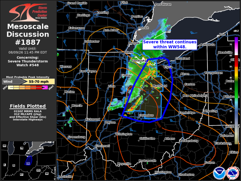
| Mesoscale Discussion 1887 | |
| < Previous MD | |

|
|
Mesoscale Discussion 1887 NWS Storm Prediction Center Norman OK 0851 PM CDT Sun Aug 09 2026 Areas affected...northern Ohio Concerning...Severe Thunderstorm Watch 548... Valid 100151Z - 100345Z The severe weather threat for Severe Thunderstorm Watch 548 continues. SUMMARY...Damaging wind potential continues within WW548. DISCUSSION...The line of thunderstorms across northern OH has weakened over the last hour. Instability decreases across eastern OH into far western PA. Further weakening is anticipated as the storms move toward this less favorable air mass. Damaging wind potential continues across the far northern portion of the line and with some redevelopment along the outflow across the southern portion of the line. A more favorably unstable air mass remains ahead of the new development near the southern portion of the line, though deep layer shear decreases with southward extent. Overall, damaging wind potential is expected to continue over the next couple of hours before gradual weakening occurs. A downstream watch is not currently anticipated but trends will be monitored. ..Thornton.. 08/10/2026 ...Please see www.spc.noaa.gov for graphic product... ATTN...WFO...PBZ...RLX...CLE...ILN... LAT...LON 41528265 40868313 40198347 39998357 39858300 39828259 39918218 40478187 40958178 41498192 41588207 41528265 MOST PROBABLE PEAK WIND GUST...55-70 MPH |
|
|
Top/All Mesoscale Discussions/Forecast Products/Home |
|
Source link