

| Mesoscale Discussion 1881 | |
| < Previous MD | |

|
|
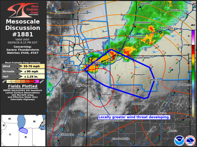
Mesoscale Discussion 1881 NWS Storm Prediction Center Norman OK 0349 PM CDT Sun Aug 09 2026 Areas affected...Northwest Indiana Concerning...Severe Thunderstorm Watch 546...547... Valid 092049Z - 092215Z The severe weather threat for Severe Thunderstorm Watch 546, 547 continues. SUMMARY...A locally greater wind threat is evident in northwest Indiana. DISCUSSION...KLOT and TMDW/TORD radar velocity data suggest a locally greater wind threat developing in northwest Indiana. Two small bowing segments are evident with around 50 kt outbound velocities. Given the strong heating and large buoyancy ahead of these storms, they will likely pose a locally greater severe wind threat over the next 1-3 hours. Depending on the persistence of these storms, additional extensions of WW 547 may become necessary. ..Wendt.. 08/09/2026 ...Please see www.spc.noaa.gov for graphic product... ATTN...WFO...IWX...LOT... LAT...LON 40898601 41158705 41288738 41488761 41898689 41528585 41268572 40918591 40898601 MOST PROBABLE PEAK TORNADO INTENSITY...UP TO 90 MPH MOST PROBABLE PEAK WIND GUST...55-70 MPH MOST PROBABLE PEAK HAIL SIZE...UP TO 1.25 IN |
|
|
Top/All Mesoscale Discussions/Forecast Products/Home |
|
Source link