

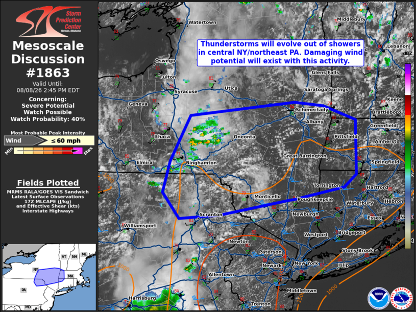
| Mesoscale Discussion 1863 | |
| < Previous MD | |

|
|
   Mesoscale Discussion 1863
   NWS Storm Prediction Center Norman OK
   1211 PM CDT Sat Aug 08 2026

   Areas affected...Northern Mid-Atlantic into parts of southern New
   England

   Concerning...Severe potential...Watch possible

   Valid 081711Z - 081845Z

   Probability of Watch Issuance...40 percent

   SUMMARY...Thunderstorm development is likely within the next 1-2
   hours. The strongest storms will be capable of wind damage. Given
   the expected scattered storm coverage a watch is possible this
   afternoon.

   DISCUSSION...Showers/towering cumulus have been deepening over the
   past hour near Binghamton. With a modest shortwave trough in the
   lower Great Lakes, the expectation is for this activity to continue
   and intensify into the mid/late afternoon. Heating within
   southeastern New York into southern New England will steepen
   low-level lapse rates. Modest deep-layer shear will allow for some
   organization, though a cluster/linear mode will be most likely. The
   strongest activity will be capable of wind damage. Trends in CAM
   guidance continue to suggest this region will see greater
   clustering/storm coverage. A watch is possible this afternoon.

   ..Wendt/Hart.. 08/08/2026

   ...Please see www.spc.noaa.gov for graphic product...

   ATTN...WFO...BOX...OKX...ALY...BGM...

   LAT...LON   41827305 41657396 41657405 41457529 41397600 41747630
               42167618 42777582 42967393 42907341 42727283 41997283
               41827305

   MOST PROBABLE PEAK WIND GUST...UP TO 60 MPH
|
|
|
Top/All Mesoscale Discussions/Forecast Products/Home |
|
Source link