

| Mesoscale Discussion 1805 | |
| < Previous MD | |

|
|
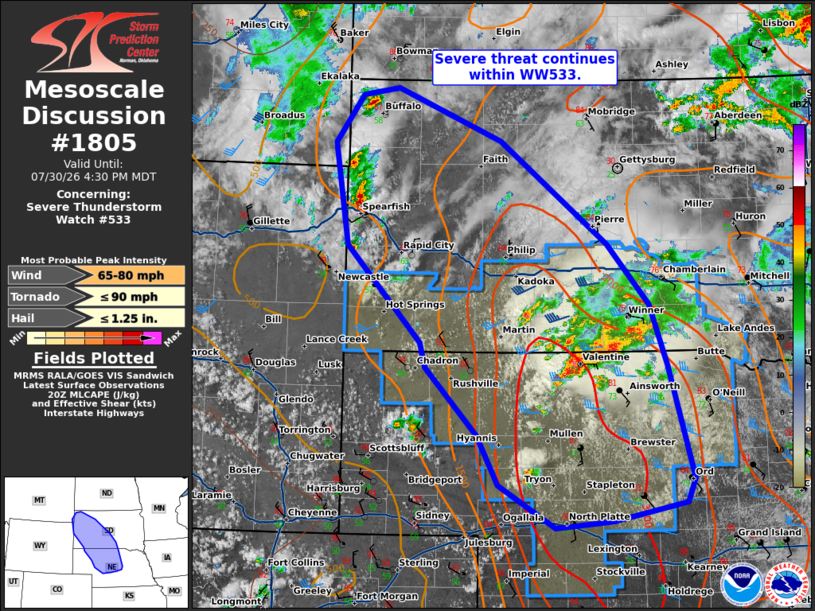
Mesoscale Discussion 1805 NWS Storm Prediction Center Norman OK 0327 PM CDT Thu Jul 30 2026 Areas affected...western South Dakota into north-central Nebraska Concerning...Severe Thunderstorm Watch 533... Valid 302027Z - 302230Z The severe weather threat for Severe Thunderstorm Watch 533 continues. SUMMARY...Severe threat continues within WW533. DISCUSSION...Supercell clusters continue across northern Nebraska/south-central South Dakota, with echo tops to 55 kft. Thus far, mode has been messy with lots of storm interactions/mergers. Recent gusts to 59 mph were measured with this cluster. It seems likely that from within this region, a cluster of storms will eventually organize along outflows/cold pools and shift southward, with an increasing damaging wind threat through the afternoon/evening. Additional storms are developing along the zone of surface confluence across western Nebraska and will continue to pose potential for large hail and damaging wind. Additional thunderstorms are ongoing further northwest across western South Dakota. Instability is less favorable in this region but sufficient deep layer shear and steep low-level lapse rates may support potential for another semi-organized cluster to emerge through the evening. Local extension of WW533 may be warranted to support this potential. ..Thornton.. 07/30/2026 ...Please see www.spc.noaa.gov for graphic product... ATTN...WFO...FSD...ABR...GID...LBF...UNR...CYS...BYZ... LAT...LON 42839926 43519951 44160013 45290173 45850328 45770382 45250423 44140402 43100293 42820284 42080207 41550177 41070093 41150008 41349899 41619889 42839926 MOST PROBABLE PEAK TORNADO INTENSITY...UP TO 90 MPH MOST PROBABLE PEAK WIND GUST...65-80 MPH MOST PROBABLE PEAK HAIL SIZE...UP TO 1.25 IN |
|
|
Top/All Mesoscale Discussions/Forecast Products/Home |
|
Source link