

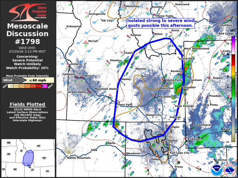
| Mesoscale Discussion 1798 | |
| < Previous MD | |

|
|
   Mesoscale Discussion 1798
   NWS Storm Prediction Center Norman OK
   0314 PM CDT Wed Jul 29 2026

   Areas affected...portions of southeastern Idaho and northern Utah

   Concerning...Severe potential...Watch unlikely

   Valid 292014Z - 292115Z

   Probability of Watch Issuance...20 percent

   SUMMARY...Isolated strong to severe wind gusts possible with
   thunderstorm activity this afternoon.

   DISCUSSION...Widely scattered thunderstorm activity is expected to
   develop this afternoon across portions of northern Utah into
   southern Idaho. Daytime heating has yielded temperatures in the
   upper 80s to 90s F and large dew point depressions, with dew points
   in the upper 40s to low 50s F. Steep lapse rates and sufficient
   MLCAPE around 500 J/kg amid deep layer shear around 30-40 kts may
   support isolated more organized cells with potential for strong to
   severe gusts. Overall, the coverage of organized storm potential is
   expected to remain low and a watch is unlikely to be needed.

   ..Thornton/Hart.. 07/29/2026

   ...Please see www.spc.noaa.gov for graphic product...

   ATTN...WFO...TFX...SLC...PIH...MSO...BOI...LKN...

   LAT...LON   41811467 43411446 44641363 44961285 45131202 45111176
               44471115 43501110 42111152 41491216 41261333 41311374
               41511419 41811467

   MOST PROBABLE PEAK WIND GUST...UP TO 60 MPH
|
|
|
Top/All Mesoscale Discussions/Forecast Products/Home |
|
Source link