

| Mesoscale Discussion 1772 | |
| < Previous MD | |

|
|
   Mesoscale Discussion 1772
   NWS Storm Prediction Center Norman OK
   0524 PM CDT Mon Jul 27 2026

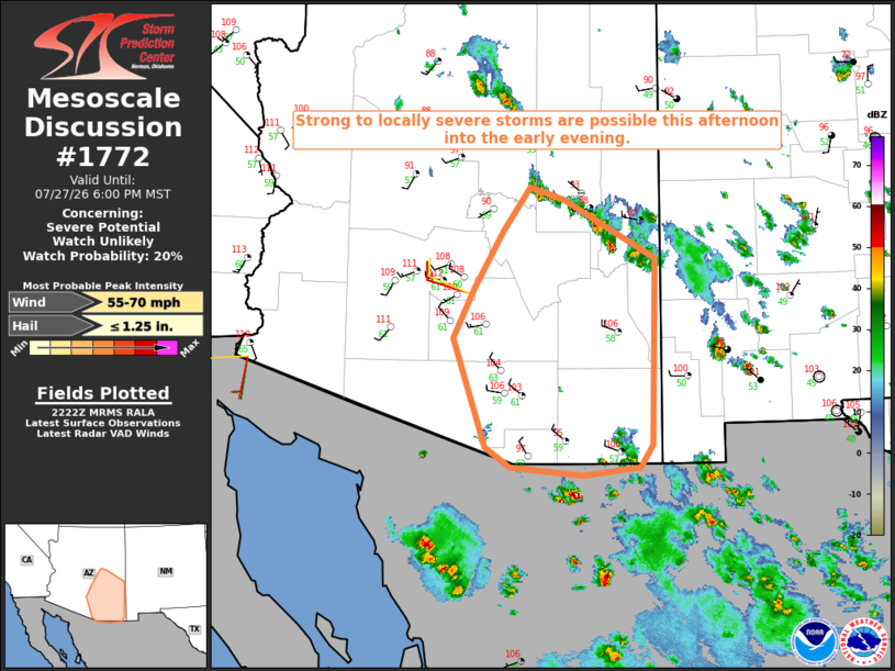
   Areas affected...Parts of southeast AZ

   Concerning...Severe potential...Watch unlikely

   Valid 272224Z - 280100Z

   Probability of Watch Issuance...20 percent

   SUMMARY...Strong to locally severe storms will be possible through
   the afternoon into the early evening.

   DISCUSSION...Scattered thunderstorms have developed this afternoon
   over the Mogollon Rim, and also across far southeast AZ. In the
   short term, steep low-level lapse rates and moderate buoyancy will
   support potential for localized downburst winds, and small to
   near-severe hail. Modest midlevel easterlies atop low-level westerly
   winds are resulting in 30-40 kt of effective shear, which may
   support occasionally organized convection, and perhaps some
   west/southwest-moving clusters as outflow begins to increase in
   coverage. This may result in a threat for strong to localized severe
   gusts to reach lower elevations from late afternoon into the early
   evening.

   ..Dean/Smith.. 07/27/2026

   ...Please see www.spc.noaa.gov for graphic product...

   ATTN...WFO...TWC...FGZ...PSR...

   LAT...LON   33341158 34001119 34501082 34371037 33680912 31540917
               31280934 31201010 31291108 31511143 32771187 33341158

   MOST PROBABLE PEAK WIND GUST...55-70 MPH
   MOST PROBABLE PEAK HAIL SIZE...UP TO 1.25 IN
|
|
|
Top/All Mesoscale Discussions/Forecast Products/Home |
|
Source link