

| Mesoscale Discussion 1744 | |
| < Previous MD | |

|
|
   Mesoscale Discussion 1744
   NWS Storm Prediction Center Norman OK
   0326 PM CDT Sun Jul 26 2026

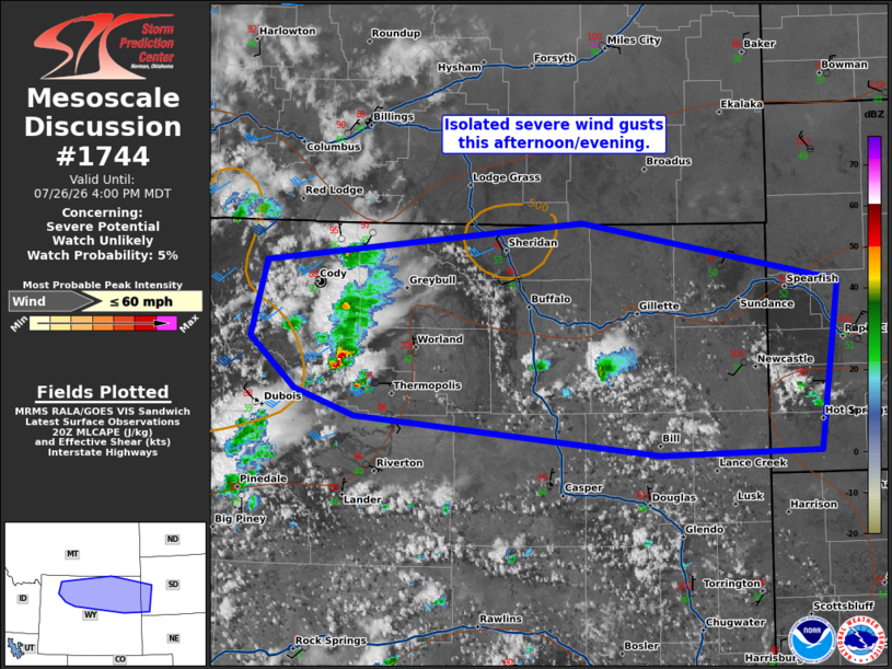
   Areas affected...northern Wyoming into far southwest South Dakota

   Concerning...Severe potential...Watch unlikely

   Valid 262026Z - 262200Z

   Probability of Watch Issuance...5 percent

   SUMMARY...Isolated severe wind gusts are possible with storms across
   northern Wyoming and far southwest South Dakota this
   afternoon/evening.

   DISCUSSION...Storms have developed off the higher terrain of the
   Tetons, Big Horns, and Black Hills this afternoon. Additional storms
   are expected within these zones this afternoon. The environment is
   not that unstable (~250 J/kg MLCAPE per SPC HRRR-Based
   Mesoanalysis), but a very deeply mixed environment (per 18Z RIW and
   UNR VWP) will support some wind threat. In addition, 50+ knots of
   flow above 300mb should provide ample shear for some storm
   organization, despite the weak instability. Therefore, isolated
   severe wind gusts are possible this afternoon/evening, but no watch
   is expected given the weak instability.

   ..Bentley/Leitman.. 07/26/2026

   ...Please see www.spc.noaa.gov for graphic product...

   ATTN...WFO...UNR...CYS...BYZ...RIW...

   LAT...LON   44690961 45010611 44520327 43170347 43140524 43460861
               43660928 44070978 44690961

   MOST PROBABLE PEAK WIND GUST...UP TO 60 MPH
|
|
|
Top/All Mesoscale Discussions/Forecast Products/Home |
|
Source link