

| Mesoscale Discussion 1706 | |
| < Previous MD | |

|
|
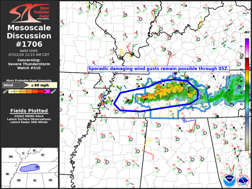
Mesoscale Discussion 1706 NWS Storm Prediction Center Norman OK 1009 PM CDT Tue Jul 21 2026 Areas affected...western and middle Tennessee Concerning...Severe Thunderstorm Watch 510... Valid 220309Z - 220515Z The severe weather threat for Severe Thunderstorm Watch 510 continues. SUMMARY...The potential for more organized severe weather appears to be diminishing. However, sporadic occurrences of damaging winds will remain possible through 05Z. DISCUSSION...Ongoing storms across middle TN have failed to sustain an organized cold pool, with only pockets of enhanced velocities noted in recent KOHX radar data. While latest objective analysis indicates the presence of a moderately unstable air mass, poor low/mid-level lapse rates are tempering updraft vigor. Locally intense downdrafts will remain capable of sporadic damaging winds over the next couple of hours. However, the potential for organized severe weather appears to be diminishing. ..Mead.. 07/22/2026 ...Please see www.spc.noaa.gov for graphic product... ATTN...WFO...OHX...MEG... LAT...LON 35478950 35848924 36068805 36248762 36318701 36258643 35928597 35648600 35478631 35338759 35218838 35258924 35478950 MOST PROBABLE PEAK WIND GUST...UP TO 60 MPH |
|
|
Top/All Mesoscale Discussions/Forecast Products/Home |
|
Source link