| Mesoscale Discussion 1697 | |
| < Previous MD | |

|
|
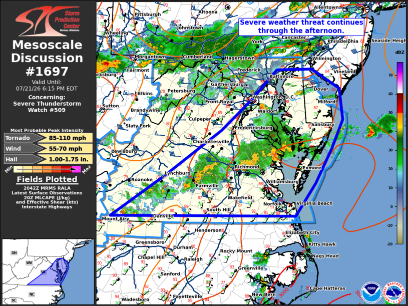
Mesoscale Discussion 1697 NWS Storm Prediction Center Norman OK 0343 PM CDT Tue Jul 21 2026 Areas affected...eastern Virginia into the DelMarVa Concerning...Severe Thunderstorm Watch 509... Valid 212043Z - 212215Z The severe weather threat for Severe Thunderstorm Watch 509 continues. SUMMARY...The severe weather threat will continue through the afternoon and into the evening. DISCUSSION...Storms across Virginia and into the DelMarVa have mostly lacked structure thus far with only occasional stronger multi-cell storms. As height falls overspread the area this evening, expect more robust convection with a greater damaging wind threat and an eventual line of storms along or ahead of the cold front, advances east. In addition, strengthening mid-level and low-level flow will assist in storm organization, further supporting the threat. ..Bentley.. 07/21/2026 ...Please see www.spc.noaa.gov for graphic product... ATTN...WFO...PHI...AKQ...LWX...RNK... LAT...LON 36648039 37457909 38317774 38907701 39477640 39497553 39107487 38507479 37967507 37297548 36677596 36648039 MOST PROBABLE PEAK TORNADO INTENSITY...85-110 MPH MOST PROBABLE PEAK WIND GUST...55-70 MPH MOST PROBABLE PEAK HAIL SIZE...1.00-1.75 IN |
|
|
Top/All Mesoscale Discussions/Forecast Products/Home |
|
Source link