

| Mesoscale Discussion 1692 | |
| < Previous MD | |

|
|
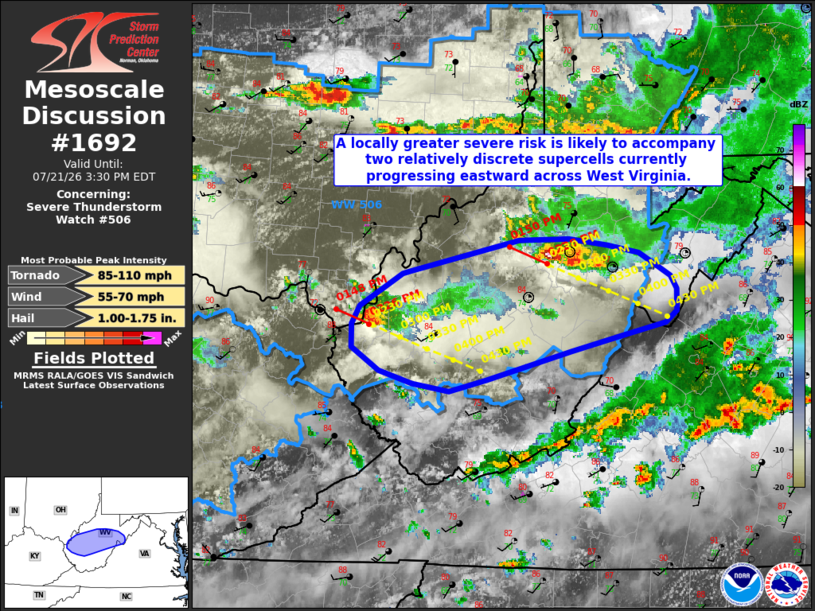
Mesoscale Discussion 1692 NWS Storm Prediction Center Norman OK 0133 PM CDT Tue Jul 21 2026 Areas affected...portions of West Virginia Concerning...Severe Thunderstorm Watch 506... Valid 211833Z - 211930Z The severe weather threat for Severe Thunderstorm Watch 506 continues. SUMMARY...A locally greater risk for all severe hazards is likely to accompany two discrete/semi-discrete supercells currently located across portions of West Virginia over the next hour or so. DISCUSSION...Radar imagery from KRLX depicts a semi-discrete supercell entering Lewis County, West Virginia, with a separate, discrete supercell noted near the Ohio River in far western West Virginia. Uncertainty remains as to how long these storms will be relatively discrete and if they will maintain their intensity as available buoyancy modestly decreases with eastward extent. However, given that these cells remain relatively discrete within a favorable thermodynamic/kinematic environment (40+ kts of effective shear and 2000-2500 J/kg MLCAPE indicated by latest mesoanalysis and 100-125 m2/s2 0-1 km SRH sampled by the RLX VWP), a locally greater severe risk is likely to exist for at least another hour in association with these supercells. ..Chalmers.. 07/21/2026 ...Please see www.spc.noaa.gov for graphic product... ATTN...WFO...LWX...RNK...RLX... LAT...LON 38588234 38838191 38858183 39088077 39098028 39057989 38997959 38907945 38807927 38717922 38537922 38447933 38367971 38228025 38018109 37928145 37988182 38088215 38258241 38438242 38588234 MOST PROBABLE PEAK TORNADO INTENSITY...85-110 MPH MOST PROBABLE PEAK WIND GUST...55-70 MPH MOST PROBABLE PEAK HAIL SIZE...1.00-1.75 IN |
|
|
Top/All Mesoscale Discussions/Forecast Products/Home |
|
Source link