

| Mesoscale Discussion 1672 | |
| < Previous MD | |

|
|
   Mesoscale Discussion 1672
   NWS Storm Prediction Center Norman OK
   1136 AM CDT Mon Jul 20 2026

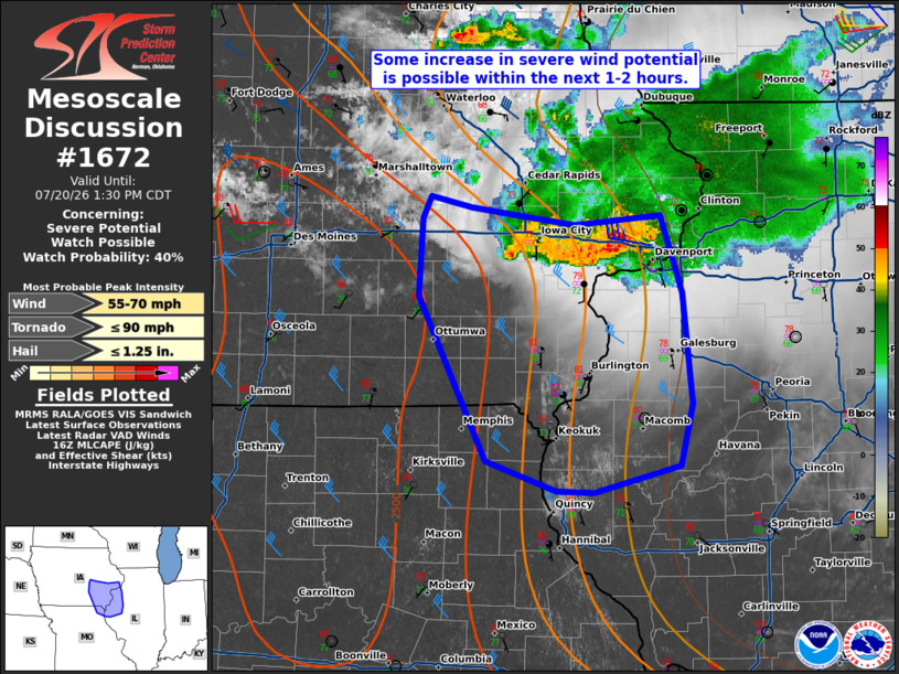
   Areas affected...Southeast Iowas into west-central Illinois and far
   northeast Missouri

   Concerning...Severe potential...Watch possible

   Valid 201636Z - 201830Z

   Probability of Watch Issuance...40 percent

   SUMMARY...Some increase in strong to severe wind gusts is possible
   with a compact MCS in east-central Iowa. A watch is possible
   depending on convective trends over the next 1-2 hours.

   DISCUSSION...Modest destabilization continues ahead of a compact MCS
   in east-central Iowa. Temperatures to the south/southwest of this
   cluster have risen into the low to upper 80s F. The motion of the
   system is generally southeastward which would tend to move it into
   less unstable air in Illinois. Activity on the western flank of the
   MCS and its trailing outflow will likely be the strongest given the
   stronger heating and steeper mid-level lapse rates. Some potential
   for strong to severe wind gusts will be present. Recent measured
   wind gusts at Cedar Rapids and Iowa City were 35 and 36 kt,
   respectively, with a mesonet site also measuring 55 mph in Jones
   County. A watch is possible depending on convective trends over the
   next hour or two.

   ..Wendt/Thompson.. 07/20/2026

   ...Please see www.spc.noaa.gov for graphic product...

   ATTN...WFO...ILX...LSX...DVN...DMX...

   LAT...LON   40259197 41299253 41789250 41919243 41859208 41799169
               41739122 41809050 41319033 40619024 40219034 40049106
               40059137 40259197

   MOST PROBABLE PEAK TORNADO INTENSITY...UP TO 90 MPH
   MOST PROBABLE PEAK WIND GUST...55-70 MPH
   MOST PROBABLE PEAK HAIL SIZE...UP TO 1.25 IN
|
|
|
Top/All Mesoscale Discussions/Forecast Products/Home |
|
Source link